Typhoon lashes coast as Thailand braces for flooding risk
TMD urges vigilance as storms sweep through multiple provinces
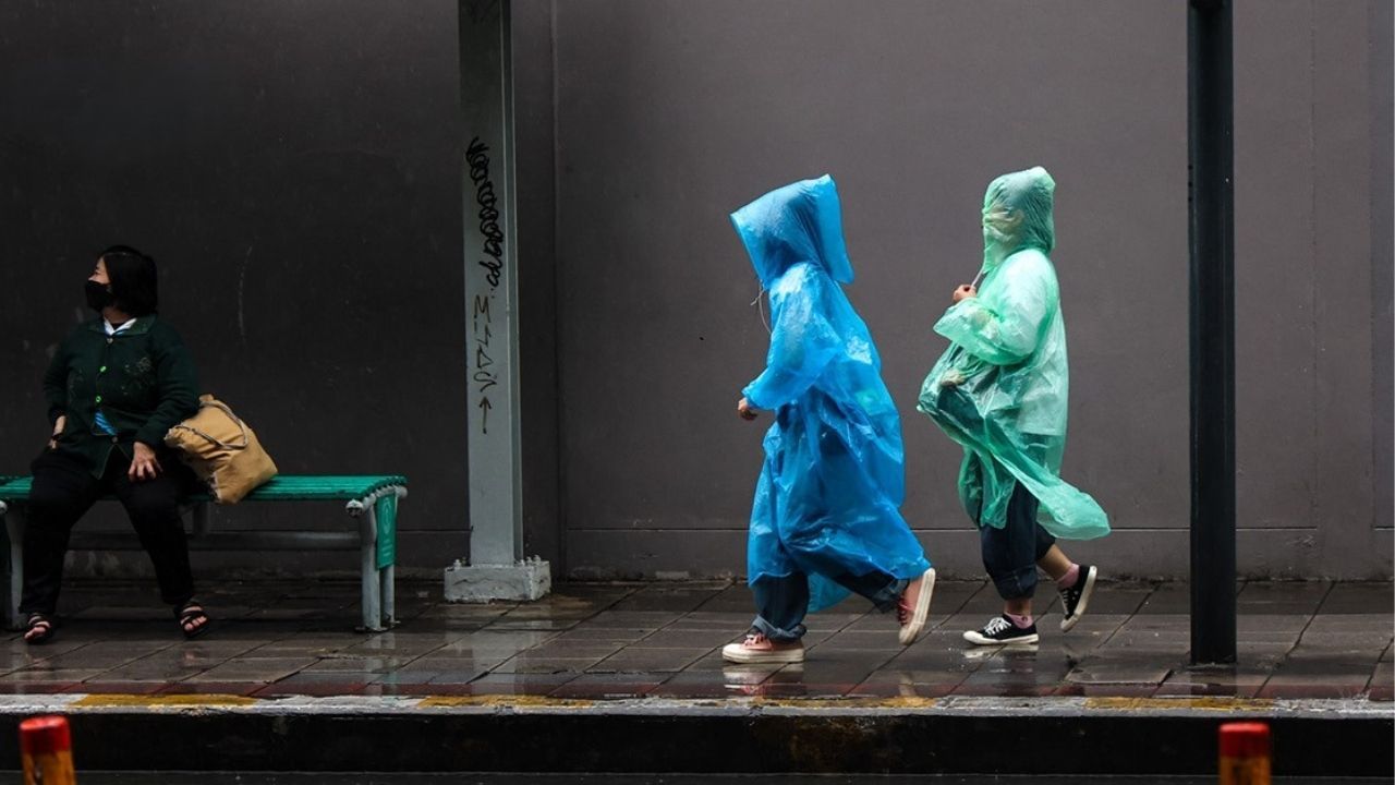
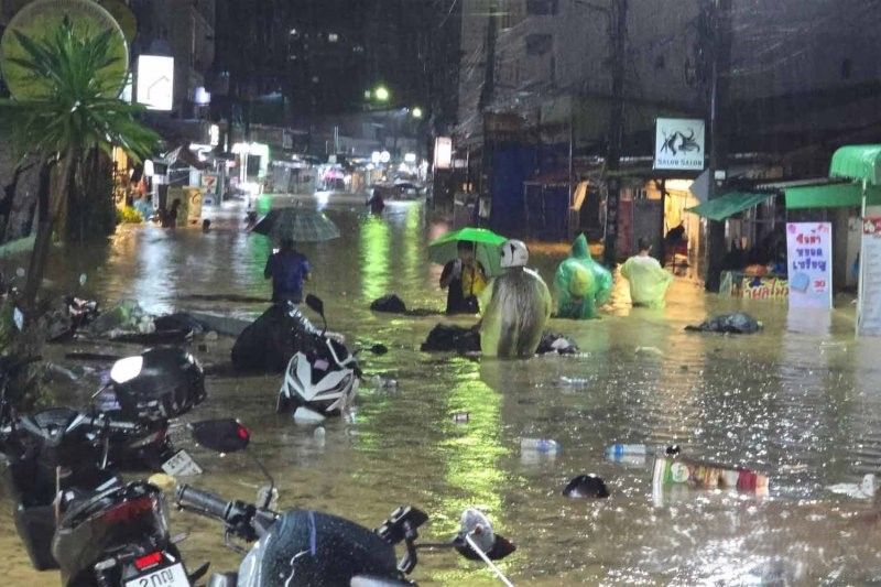
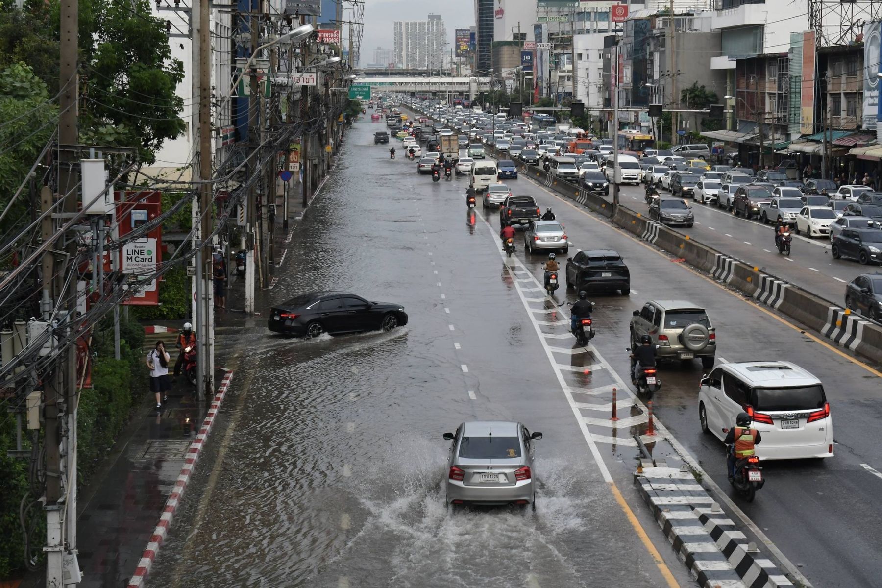
Thailand braces for severe weather as a typhoon moves inland, bringing strong winds, heavy rain, and flood risks to several regions across the country.
The Thai Meteorological Department (TMD) has warned of widespread rainfall, strong winds and isolated heavy to very heavy downpours across the northeast, especially in provinces such as Ubon Ratchathani, Yasothon, Amnat Charoen, Sisaket, and Surin. Residents in these areas, particularly those living near foothills, low-lying areas and waterways, are urged to stay alert for possible flash floods and overflowing rivers.
Farmers have been advised to prepare for potential damage to crops, as strong monsoon conditions sweep across the upper South, the upper Gulf of Thailand and the east. In coastal regions, especially along the Andaman Sea and upper Gulf, strong winds are expected to whip up waves of 2 to 3 metres, with waves surging beyond 3 metres in areas experiencing thunderstorms. Small boats have been advised to remain ashore.
The forecast from 6pm yesterday, November 6, to 6pm today, November 7, is as follows:
In northern Thailand, the morning will be cool with isolated rainfall, mainly in Mae Hong Son, Chiang Mai and Lamphun. Minimum temperatures will range from 22 to 24°C, and highs from 29 to 32°C. Mountain tops may see lows between 10 and 14°C. Winds are expected from the east at 10 to 15 km/h.
The central region can expect isolated thundershowers, particularly in Kanchanaburi, Ratchaburi, Nakhon Pathom, Samut Sakhon and Samut Songkhram. Temperatures will vary between 22 and 25°C at night and 29 and 32°C during the day, with easterly winds at 10 to 20 km/h.
In the east, scattered thundershowers are likely in Sa Kaeo, Prachin Buri, Chon Buri, Rayong, Chanthaburi and Trat. Temperatures will range from 23 to 25°C in the morning to 30 to 32°C in the afternoon. Winds from the east will blow at 20 to 35 km/h, with wave heights around 2 metres and exceeding 2 metres during thunderstorms.


Along the east coast of the south, expect scattered thundershowers and isolated heavy rain in Phetchaburi, Prachuap Khiri Khan, Chumphon and Surat Thani. From Chumphon upwards, variable winds will reach 20 to 35 km/h with two-metre waves. From Surat Thani southwards, westerly winds of 15 to 30 km/h will create waves of about 1 metre and up to 2 metres offshore, rising higher in stormy areas.
The west coast, including Ranong, Phang Nga, Phuket, Krabi, Trang and Satun, will experience widespread thunderstorms and isolated heavy rain. Minimum temperatures will sit between 23 and 25°C, and highs between 28 and 33°C. Southwesterly winds of 20 to 40 km/h will push waves to heights of 2 to 3 metres, exceeding 3 metres in thundershowers.
Bangkok and surrounding areas will see isolated thundershowers, with temperatures ranging from 24 to 25°C in the morning to 30 to 32°C during the day. Winds will blow from the east at 10 to 20 km/h.
Residents across affected areas are urged to stay updated via official channels and report emergencies through the Safety Hotline 1784.
Latest Thailand News


Follow The Thaiger on Google News: