Thailand shivers up north as southern seas turn rough

Thailand is in the grip of a weather shift as a cold front sweeps through the north, while the south contends with heavy rainfall and rough seas.
A strong high-pressure system from China continues to dominate the upper regions of Thailand, pushing cool to cold air across northern and northeastern areas.
The forecast from 6am today, November 22, to 6am tomorrow, November 23, is as follows:
Mountain tops in the north are facing temperatures as low as 4°C, with the general region dipping to between 15 to 20°C. Daytime highs are expected to range from 28 to 31°C, with light to moderate northeasterly winds blowing at 10 to 20 km/hr.
In the northeast, conditions remain chilly. Morning temperatures are forecast at 13 to 19°C, climbing to 27 to 29°C during the day. Mountainous areas will feel colder, with lows between 8 to 12°C. Northeasterly winds in this region are slightly stronger, ranging from 10 to 30 km/hr.

Central Thailand, including Bangkok, will see cool mornings with temperatures ranging from 20 to 22°C, warming up to 28 to 30°C. Winds are expected to flow in from the northeast at speeds of 10 to 25 km/hr.
The east will experience similar cool mornings. Minimum temperatures are expected to be between 20 and 23°C, reaching daytime highs of 28 to 31°C. Northeasterly winds will be stronger at 20 to 40 km/hr, and the sea will be rough with waves reaching 1 to 2 metres, and over 2 metres offshore.


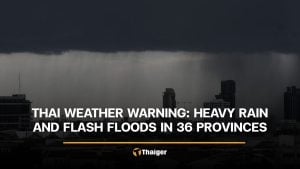
Meanwhile, the south is in for another round of wild weather. The northeast monsoon continues to blow strongly over the Gulf, the south, and the upper Andaman Sea. Combined with a low-pressure system over the lower South, this will bring widespread thundershowers with isolated heavy to very heavy rain.
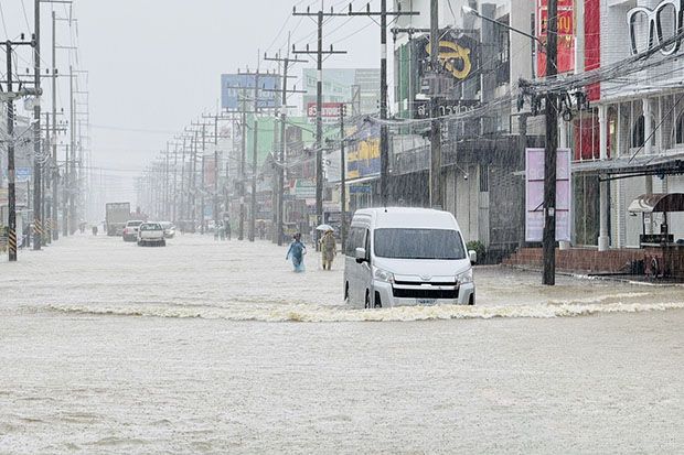
On the east coast, provinces such as Nakhon Si Thammarat, Phatthalung, Songkhla, Pattani, Yala and Narathiwat can expect downpours. Minimum temperatures will range from 21 to 24°C, with highs between 26 and 30°C. Winds will be fierce, blowing at 20 to 40 km/hr. Waves in the Gulf will be 2 to 3 metres high, exceeding 3 metres in stormy areas.
On the west coast, including Phuket, Krabi, Trang and Satun, rain is also expected. Temperatures will range from 23 to 24°C, with highs between 26 and 29°C. Northeasterly winds from Krabi northward will blow at 20 to 40 km/hr, with waves reaching 2 metres near the shore, 2 to 3 metres offshore, and more than 3 metres in thundershowers.
South of Trang, waves will be slightly calmer at 1 to 2 metres, rising beyond 2 metres in stormy waters, according to the Thai Meteorological Department (TMD).
Bangkok will see a chilly start, with temperatures hovering between 21 and 23°C in the morning and climbing to 29 to 30°C later in the day. Winds from the northeast will sweep through the capital at 10 to 25 km/hr.
Latest Thailand News


Follow The Thaiger on Google News: