Thai Air Force mobilises to aid northern regions in flood relief efforts
The Royal Thai Air Force (RTAF) mobilised aircraft to survey flood-hit regions, relaying vital data to support water drainage routes and delivering aid in a comprehensive flood relief programme.
Yesterday, August 25, RTAF Chief Marshal Phanpakdee Patanakun announced efforts to assist those affected by the severe flooding in northern Thailand. The RTAF is deploying all available resources and coordinating with various sectors to offer comprehensive relief as swiftly as possible.
The RTAF dispatched an EC-725 helicopter from Wing 41 in Chiang Mai to conduct aerial reconnaissance over the flood-affected areas in northern Thailand. The mission includes surveying Mueang district in Phrae province, Sirikit Dam in Tha Pla district, Uttaradit province, and Mueang district, Nan province, as well as Sukhothai province and nearby areas.
The purpose was to gather aerial images that can assist relevant agencies in assessing the flood situation and planning further relief efforts.
Additionally, Wing 3’s Unmanned Aerial Vehicle (drone) unit in Watthana Nakhon district, Sa Kaeo province, has been tasked with capturing aerial images to monitor incoming water masses. This data will be crucial for agencies in forecasting and preparing for potential impacts in central and other regions.
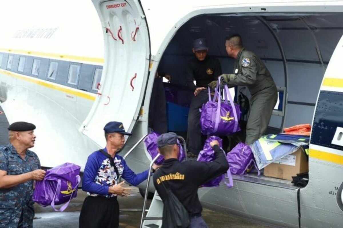
The RTAF’s assistance strategy also includes the deployment of transport aircraft from Wing 46, acting under the Disaster Relief Operation Centre. The RTAF is utilising Type 2G transport planes from Squadron 461, typically used for cloud seeding missions, to deliver essential supplies.
These supplies include survival kits and disaster relief boats, vital for areas where ground routes are impassable due to high water levels spreading across multiple provinces.


Air Chief Marshal Phanpakdee Patanakun emphasised the importance of integrating efforts across sectors to ensure effective and timely aid to those in need.
The comprehensive approach includes detailed aerial surveys to provide up-to-date information on flood conditions, enabling more accurate and responsive relief measures. The use of both helicopters and drones ensures extensive coverage and data collection, crucial for managing the flood crisis.
The aerial reconnaissance and data collection efforts are not limited to the immediate affected areas but also extend to regions potentially at risk of incoming floodwaters. This proactive strategy aims to mitigate further damage and prepare communities for potential impacts, reported KhaoSod.
Latest Thailand News


Follow The Thaiger on Google News: