Thailand braces for cold snap and heavy southern rainfall

Thailand’s Meteorological Department has issued a warning of cold weather, strong winds, and frost, whilst also alerting the southern region to heavy rainfall. The announcement, issued today, informed that a high-pressure system or cold air mass is still covering Thailand and the southern part of the South China Sea.
This is resulting in cold to very cold weather with strong winds across the country. In the mountainous areas of the northern region, temperatures are dropping to between 3 and 13 degrees Celsius, with frost occurring in some areas. Similarly, the mountainous areas of the northeastern region are experiencing cold to very cold weather, with the lowest temperatures recorded between 5 and 13 degrees Celsius. Residents in these areas are advised to take care of their health due to the cold weather and to be aware of potential fires caused by dry conditions and strong winds.
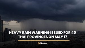
Meanwhile, the prevailing northeast monsoon over the Gulf of Thailand and the southern region is intensifying. From today to tomorrow, a strong low-pressure area near the Malaysian coast is expected to move across the lower southern region and Malaysia to the lower Andaman Sea. This will lead to heavy to very heavy rainfall in some areas of the lower southern region, reported KhaoSod.
Today, the provinces that are expected to experience heavy to very heavy rainfall include Surat Thani, Nakhon Si Thammarat, Pattalung, Songkhla, Pattani, Yala, Narathiwat, Trang, and Satun. On the following day, Nakhon Si Thammarat, Pattalung, Songkhla, Pattani, Yala, and Narathiwat are likely to continue to experience heavy rainfall. Residents in these areas are urged to be cautious of heavy rainfall and accumulated rain, which may lead to sudden flooding and runoff, especially in areas near mountain slopes and low-lying areas.
As for the sea conditions, waves in the Gulf of Thailand are expected to reach a height of 2 to 4 metres. In areas with thunderstorms, the wave height may exceed 4 metres. The Andaman Sea will see waves of approximately 2 metres, and in areas with thunderstorms and far from the shore, the wave height may exceed 2 metres. Residents along the east coast of the southern region are warned of dangers from waves hitting the shore. Boat operators in the Gulf of Thailand and the Andaman Sea are advised to navigate with caution and avoid sailing in areas with thunderstorms. Small boats in the Gulf of Thailand should avoid leaving the shore during this period.
The statement urges the public to follow announcements from the Meteorological Department and to keep track of information on the department’s website or by calling 0-2399-4012-13 and 1182, available 24 hours a day. The statement was issued today at 5am. The Meteorological Department will issue the next statement today at 5pm.


Latest Thailand News


Follow The Thaiger on Google News: