Thailand braces for cool snaps and storms as Kalmaegi nears
Typhoon approaches from Vietnam as coastal waters grow rough

Thailand will face cooler mornings in the north and storms in the south, as changing weather patterns and an incoming typhoon bring shifting conditions.
The Thai Meteorological Department (TMD) has issued a warning for shifting weather patterns influenced by a monsoon trough stretching across the upper south, the Gulf of Thailand, and into a low-pressure cell over Vietnam’s coastal region. Meanwhile, a moderate high-pressure system from China continues to cover the northeast.
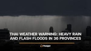
Residents in upper Thailand can expect drier skies, but the south will see isolated heavy rains, especially in coastal provinces. Farmers have been urged to monitor conditions closely to avoid crop damage, while the general public is advised to take care of their health due to sudden temperature changes and ongoing rainfall in certain areas.
Typhoon Kalmaegi, currently over the central South China Sea, is expected to make landfall in central Vietnam between today, November 6, and tomorrow, November 7. From there, it will weaken into a tropical storm and then a tropical depression as it passes through Laos and into Ubon Ratchathani province tomorrow. The system is forecast to degrade further into an active low-pressure cell.

The forecast from 6pm yesterday, November 5, to 6pm today is as follows:
In the north, residents will wake up to chilly conditions and light rain, particularly in Mae Hong Son, Chiang Mai, Tak and Lamphun. Daytime temperatures will reach between 29°C and 32°C, while mountaintops could drop to as low as 11°C. Winds will be light, blowing from the east at 10 to 15 km/h.
The northeast will also see cool mornings, with minimal rain mainly in the upper areas. Temperatures will range from 19 to 31°C, and mountaintops may experience temperatures as low as 13°C. Winds from the northeast are expected at 10 to 20 km/h.


In the central region, isolated showers are forecast for areas including Kanchanaburi and Ratchaburi, with temperatures between 22°C and 32°C and easterly winds at 10 to 20 km/h.
Eastern provinces such as Chon Buri and Rayong can expect isolated rain and sea waves of 1 to 2 metres, reaching higher during thundershowers. Winds will reach up to 35 km/h.
Along the east coast of the south, scattered thunderstorms and isolated heavy rain are likely in provinces like Chumphon and Surat Thani. Temperatures will hover between 21°C and 34°C, with westerly winds of 15 to 30 km/h. Offshore wave heights will reach 2 metres or more during storms.
On the west coast, particularly in Phuket, Krabi, and Satun, scattered heavy rain is forecast. Winds from the southwest will blow at 20 to 35 km/h, bringing wave heights of around 2 metres, and even higher in stormy conditions.
Bangkok and its surrounding areas will see occasional light rain, with morning lows of 23°C to 25°C and highs around 31°C. Winds will remain mild from the east at 10 to 20 km/h.
As Thailand prepares for Kalmaegi’s weakened arrival, TMD urges the public, especially in vulnerable southern provinces, to stay alert for updates and possible flash flooding.
Latest Thailand News


Follow The Thaiger on Google News: