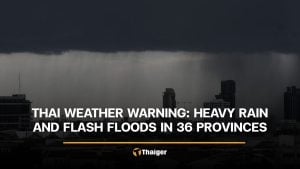
Monsoon rains and cold snap to rattle parts of Thailand
Cooler temperatures and strong winds forecast across regions

Thailand is bracing for turbulent weather as a monsoon trough and incoming typhoon combine to bring rain, wind and cooler temperatures across the country.
A monsoon trough stretching across the lower central and eastern regions of Thailand is linking with a low-pressure cell over Vietnam’s central coast. At the same time, a moderate high-pressure system from China is pressing into northeastern Thailand. This atmospheric clash is expected to bring fluctuating weather, scattered rain, isolated heavy downpours, and a drop in temperatures across parts of the country.
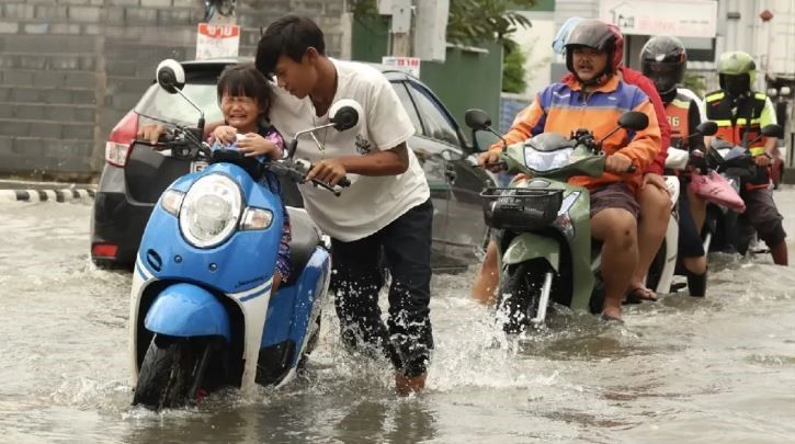
Weather officials warn that residents in upper Thailand and the upper south should prepare for cooler mornings and potential flooding. Farmers are urged to protect crops from damage due to shifting conditions.
Meanwhile, Typhoon Kalmaegi, currently over the Pacific Ocean east of the Philippines, is forecast to enter the middle South China Sea between November 4 and 5. It’s expected to make landfall in central Vietnam around November 6 to 7 before weakening into a tropical depression and moving across upper Thailand. Officials are closely monitoring its development.
The forecast from 6am today, November 4, to 6am tomorrow, November 5, is as follows:
In North Thailand, residents can expect cool mornings with isolated thundershowers and pockets of heavy rain in provinces such as Chiang Mai, Mae Hong Son, and Sukhothai. Temperatures will range from 21 to 24°C, rising to highs of 28 to 32°C. On mountaintops, it’ll drop further, hitting chilly lows of 10 to 14°C. Winds will be light, coming from the southeast at 10 to 15 km/h.


Northeastern areas will also see a 1 to 2°C drop in temperature, with morning chills and isolated thundershowers, especially in Yasothon and Ubon Ratchathani. Minimum temperatures will be around 20 to 23°C, while highs stay between 28 and 31°C. Mountain areas may see lows of 14 to 18°C, with winds blowing from the northeast at 10 to 20 km/h.
Central Thailand can expect scattered thundershowers and isolated heavy rain in provinces such as Kanchanaburi and Ayutthaya. Temperatures will range from 22 to 24°C in the morning, rising to 30 to 32°C during the day. Winds will vary from 10 to 20 km/h.

Eastern provinces such as Chon Buri and Rayong will see widespread showers with isolated heavy rain. The mercury will range from 23 to 25°C, peaking at 30 to 33°C. Coastal winds will blow at 15 to 30 km/h, with wave heights around 1 metre, increasing to over 2 metres during thunderstorms.
On the east coast of southern Thailand, provinces such as Phetchaburi may see scattered showers and occasional heavy rainfall. Temperatures will range between 22 and 25°C in the morning, rising to 30 to 34°C. Westerly winds are expected to reach speeds of 15 to 30 km/h, with sea levels around 1 metre, climbing higher during storms.
The west coast, including areas such as Ranong and Phang Nga, will also be hit with scattered storms and heavy rain. Temperatures will sit between 24 and 26°C in the early hours, climbing to highs of 30 to 33°C. Southwesterly winds of 15 to 35 km/h will whip up waves between 1 to 2 metres, with heights exceeding 2 metres during thunderstorm activity.
Bangkok and surrounding provinces are also on alert for scattered thundershowers and isolated heavy rain. The capital will see lows of 24 to 25°C and highs of 31 to 33°C, with light variable winds between 10 to 20 km/h.
The Meteorological Department (TMD) is urging the public to remain vigilant, particularly in flood-prone areas, as the combination of seasonal troughs and incoming storms continues to bring turbulence across the nation.
Latest Thailand News


Follow The Thaiger on Google News: