Thailand braces for heavy rain and thunderstorms
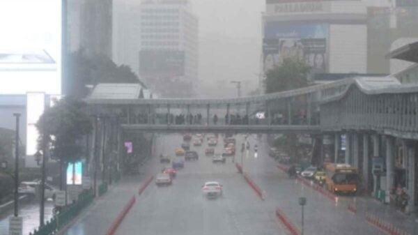
Heavy rainfall is expected across Thailand tomorrow, with Bangkok likely to be affected. Approximately 60% of the area in the capital will experience thunderstorms. The Andaman Sea and the Gulf of Thailand will see wave heights of 1 to 2 metres, with marine travel in stormy areas advised against.
The Thai Meteorological Department (TMD) issued a 24-hour weather forecast at 11pm yesterday, July 2, predicting that the southwest monsoon would cover the Andaman Sea, Thailand, and the Gulf of Thailand. Additionally, a low-pressure area would blanket upper Vietnam.
Such weather conditions will result in thunderstorms continuing across Thailand, with heavy rain expected in some parts of the upper northeastern and eastern regions. Residents in these areas are advised to be cautious of potential dangers from heavy downpours.
The forecast warned, noted that wave heights could exceed 2 metres in stormy conditions.
“Avoid sailing in areas with thunderstorms.”
In the northeast region, thunderstorms will affect 60% of the area, with heavy rain in some parts, including Loei, Nong Khai, Bueng Kan, Nong Bua Lamphu, Udon Thani, Sakon Nakhon, Nakhon Phanom, Mukdahan, Chaiyaphum, and Nakhon Ratchasima. Temperatures will vary between 24 and 27°C at the lowest and 32 to 34°C at the highest.
In the central region, thunderstorms are expected in 40% of the area, notably in Lopburi, Saraburi, Phra Nakhon Si Ayutthaya, Kanchanaburi, Ratchaburi, Nakhon Pathom, and Samut Sakhon. The temperature will drop to between 24 and 27°C, with highs of 35 to 37°C.


In the eastern region, thunderstorms are anticipated in 60% of the area, with heavy rain in some parts, particularly in Nakhon Nayok, Prachinburi, Chachoengsao, Chon Buri, Rayong, Chanthaburi, and Trat. The temperature will range from 23 to 27°C at the lowest and from 32 to 35°C at the highest. Wave heights in the sea will be around 1 metre, increasing to over 2 metres in stormy areas.
In the southeast region, thunderstorms will hit 30% of the area, mainly in Chumphon, Surat Thani, Nakhon Si Thammarat, Phatthalung, Songkhla, Pattani, Yala, and Narathiwat. The temperature will drop to between 23 and 27°C, with highs of 33 to 36°C. Sea waves will be about 1 metre high, increasing to over 2 metres during thunderstorms.
In the southern region (west coast), thunderstorms are predicted in 20% of the area, particularly in Ranong, Phang Nga, and Satun. Temperatures will range from 25 to 26°C at the lowest and from 33 to 35°C at the highest. Sea waves will be approximately 1 metre high, with higher waves in stormy areas.
In Bangkok and surrounding areas, thunderstorms are expected in 60% of the area. The temperature will drop to between 25 and 28°C, with highs of 35 to 37°C, reported KhaoSod.
Latest Thailand News


Follow The Thaiger on Google News: