May 27: Southwest monsoon intensifies as Thailand braces for heavier rain

Thailand’s Meteorological Department has issued a weather forecast for today, May 27, warning of thundershowers and isolated heavy rain across most regions as the southwest monsoon continues to strengthen over the Andaman Sea, the Gulf of Thailand, and the country as a whole.
Waves in the upper Andaman Sea are expected to reach around two metres, rising above two metres during thundershowers. In the lower Andaman Sea and upper Gulf, waves of one to two metres are forecast, also exceeding two metres in thundershowers. All vessels are advised to avoid sailing through storm cells.
The department has flagged an escalation in conditions between May 28 and June 1, when a monsoon trough is expected to settle across the upper country. The southwest monsoon is forecast to intensify, bringing heavier and more widespread rainfall nationally, with isolated very heavy rain likely in the East and along the southern west coast.
Waves in the upper Andaman Sea are expected to reach two to three metres during this period, with heights above three metres possible during thundershowers.
Regional forecasts for today
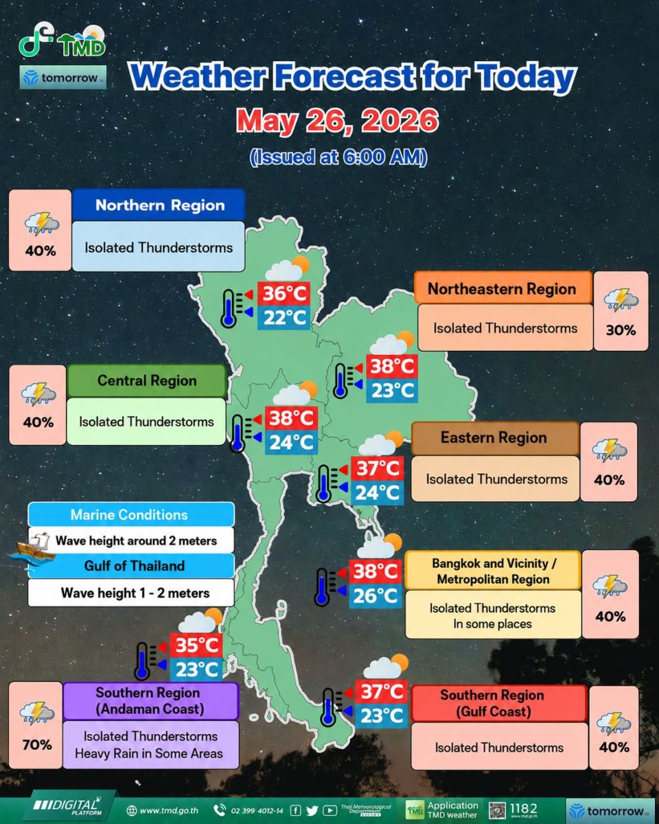
In the North, scattered thundershowers are forecast across Mae Hong Son, Chiang Mai, Lamphun, Phayao, Nan, Uttaradit, Tak, Kamphaeng Phet, Phichit, Phitsanulok, and Phetchabun. Temperatures will range from a minimum of 22 to 26 degrees Celcius (°C) and a maximum of 34 to 37°C, with southwesterly winds at 10 to 20 km/h.
The Northeast can expect isolated thundershowers in Loei, Nong Khai, Bueng Kan, Chaiyaphum, Khon Kaen, Kalasin, Maha Sarakham, Roi Et, and Nakhon Ratchasima. Temperatures will sit between 24 and 26°C at the low end, reaching 35 to 38°C during the day, with southwesterly winds at 10 to 20 km/h.
In the Central region, scattered thundershowers are expected across Nakhon Sawan, Uthai Thani, Lop Buri, Saraburi, Kanchanaburi, Ratchaburi, Nakhon Pathom, and Samut Songkhram. Minimum temperatures will be 25 to 27°C and maximums 36 to 38°C, with southwesterly winds at 10 to 20 km/h.


The East will see scattered thundershowers primarily in Nakhon Nayok, Prachinburi, Rayong, Chanthaburi, and Trat. Temperatures will range from 24 to 27°C up to 33 to 38°C. Southwesterly winds are forecast at 15 to 35 km/h, with coastal wave heights of one to two metres and above two metres in storm cells.
Along the southern east coast, scattered thundershowers and some heavy falls are forecast for Chumphon, Surat Thani, and Nakhon Si Thammarat. Temperatures will be 23 to 26°C at the low end and 34 to 36°C at the high end.
Southwesterly winds of 15 to 35 km/h are expected, with wave heights of around one metre nearshore and one to two metres offshore, exceeding two metres in thundershowers.
The southern west coast faces the most significant conditions, with fairly widespread thundershowers and isolated heavy rain forecast for Ranong, Phang-nga, and Phuket. Temperatures will range from 23 to 26°C at the minimum and 31 to 34°C at the maximum.
From Phang-nga northward, southwesterly winds of 20 to 35 km/h are expected with wave heights of around two metres, rising above two metres in storms. From Phuket southward, winds of 15 to 35 km/h are forecast with wave heights of one to two metres, also exceeding two metres during thundershowers.
Bangkok residents can expect isolated thundershowers, most likely during the afternoon and evening. Temperatures will range from 26 to 28°C overnight to 35 to 38°C during the day, with southwesterly winds at 10 to 20 km/h.
Latest Thailand News

























Follow The Thaiger on Google News: