Bangkok underpass shut after flooding chaos and cable theft
Satellite data reveals submerged farmland across four provinces
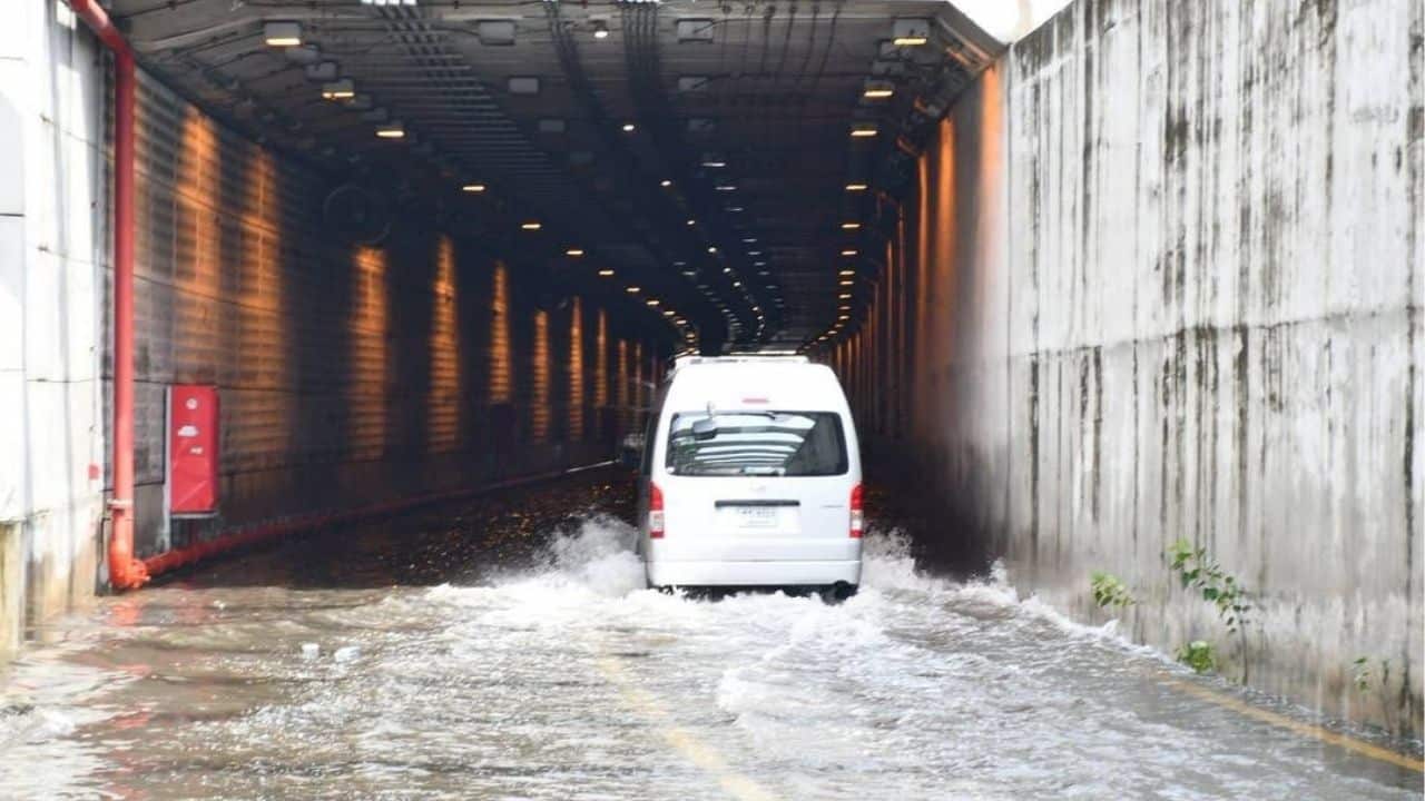
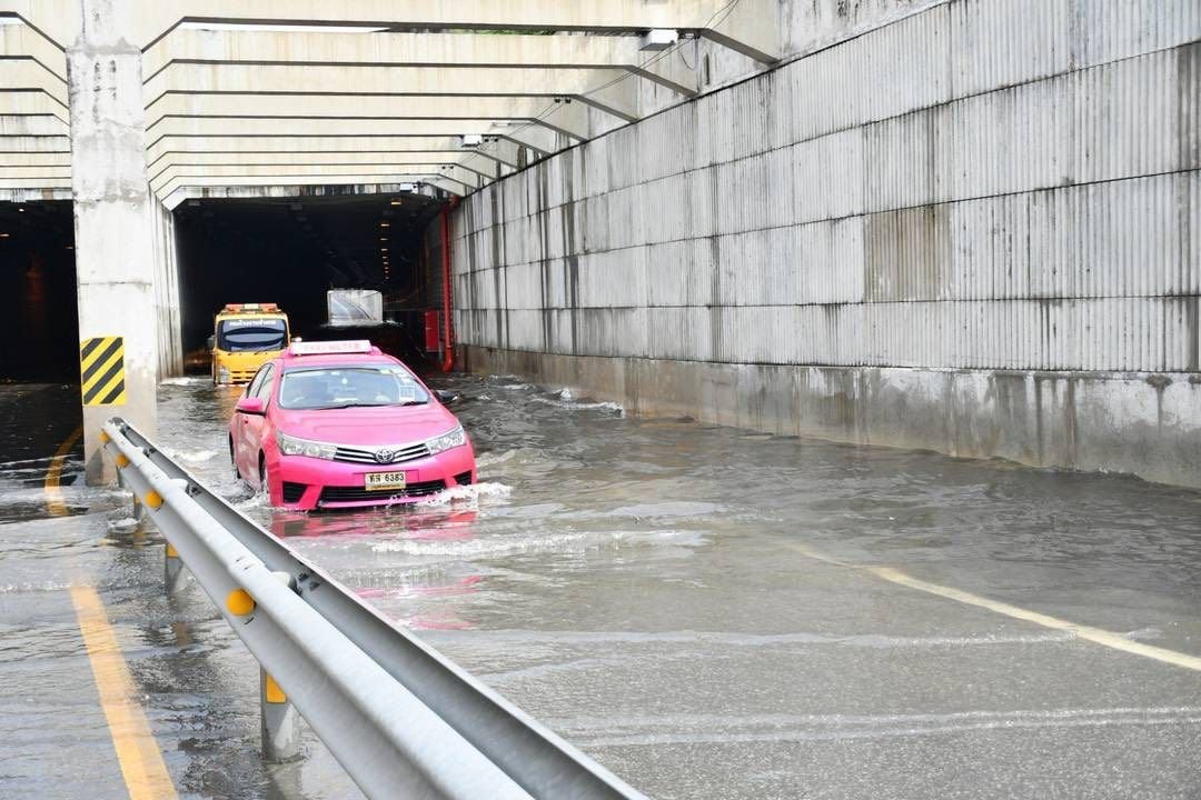
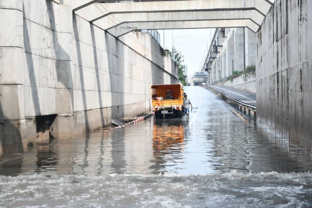
Flooding caused by cable theft and torrential rain forced officials in Bangkok to close a major underpass while nearby provinces battled widespread inundation.
Officials in Bang Sue confirmed that the underpass along the railway road had to be shut down due to waterlogging, which was compounded by the theft of electrical cables powering the drainage system. Without operational pumps, water quickly accumulated following the overnight downpour.
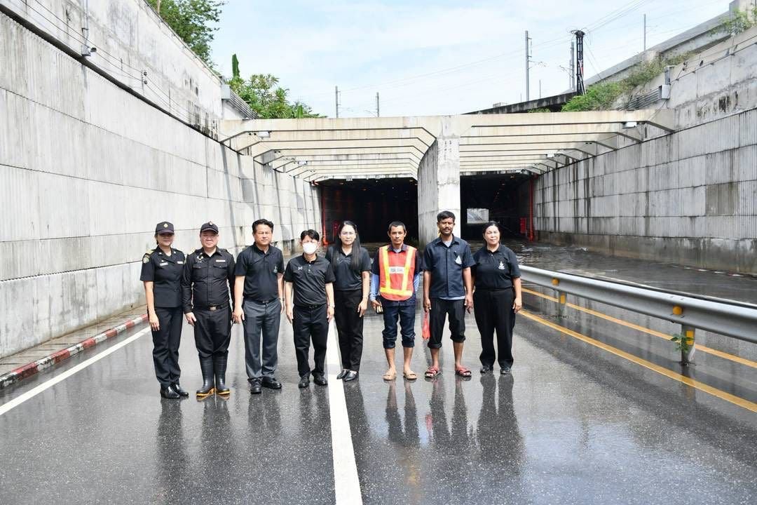
Bang Sue District Director Thawatchai Jansae, municipal officers, and engineers inspected the site and confirmed coordination with the State Railway of Thailand (SRT) to expedite repairs.
“We are working urgently to restore the pump system and reopen the road.”


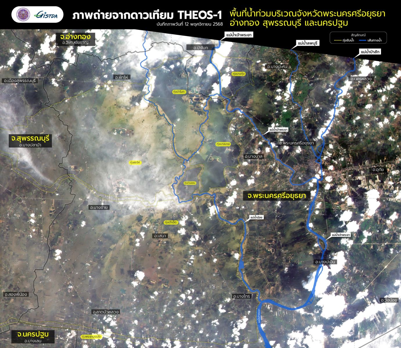
Meanwhile, satellite images from the Geo-Informatics and Space Technology Development Agency (GISTDA) revealed widespread flooding across central Thailand. According to GISTDA, over 813,000 rai (1,300 square kilometres) of land has been submerged in Ayutthaya, Ang Thong, Suphan Buri and Nakhon Pathom.
Ayutthaya has been worst hit, with 405,067 rai underwater in 12 districts, including Sena, Phak Hai, Bang Ban, and Bang Pa-in. Suphan Buri recorded flooding in more than 323,000 rai, while Nakhon Pathom’s Bang Len district saw over 82,000 rai inundated. In Ang Thong, about 2,932 rai in Pa Mok district has been affected.
Much of the flooding occurred in low-lying agricultural zones and riverside communities. GISTDA’s THEOS-1 satellite provided detailed imagery distinguishing between new and prolonged flooding based on water colour, helping officials better assess the situation, reported The Nation and Bangkok Post.

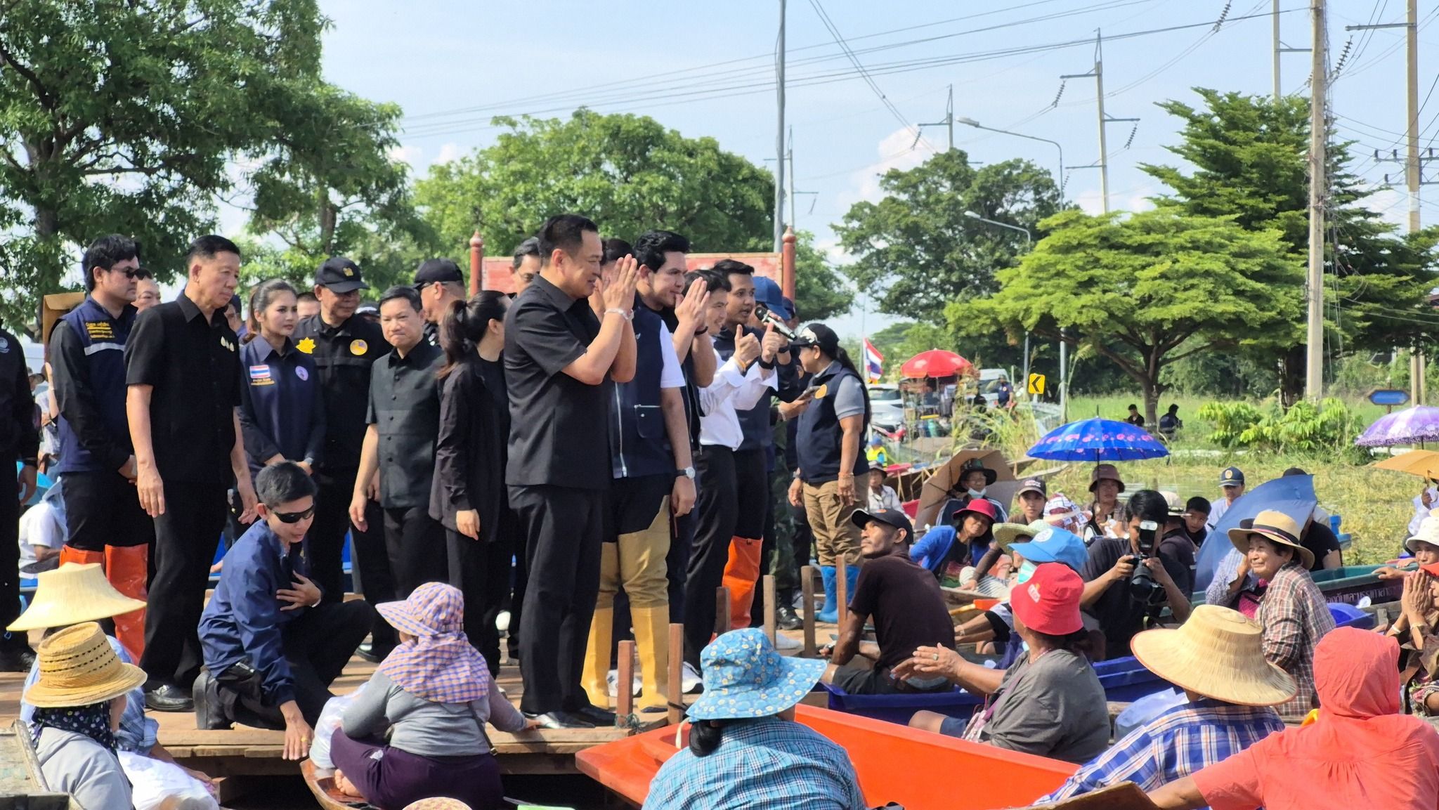
During a recent visit to Ayutthaya, Prime Minister Anutin Charnvirakul acknowledged the region’s hardship. He promised monthly compensation for farmers and landowners until water levels recede. Locals have criticised the government for allegedly prioritising Bangkok’s safety over upstream communities.
GISTDA affirmed its commitment to providing up-to-date satellite data and imagery to aid flood and disaster management. The agency, under the Ministry of Higher Education, Science, Research and Innovation, has modified its satellite signal plans to monitor flood-prone areas.
Officials continue to urge caution and are working to minimise disruptions while flood mitigation efforts are underway across the capital and nearby provinces.
Latest Thailand News


Follow The Thaiger on Google News: