Temperature rise in Thailand as cold air pressure decreases

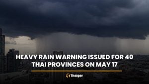
The Thai Meteorological Department (TMD) reports a decrease in cold air pressure, resulting in a rise in temperature by 1 to 3 degrees Celsius. Southern regions are experiencing heavy rainfall, with eight provinces affected as of 5am today.
The forecast for the next 24 hours indicates that the high-pressure area or cold air mass covering the upper part of Thailand is weakening.
This condition has caused the temperature in these regions to increase by 1 to 3 degrees Celsius. Residents in the northern part of Thailand are urged to remain vigilant and look after their health due to the rapidly changing weather conditions. The northeast monsoon prevailing over the Gulf of Thailand and the Deep South remains moderate, coupled with a low-pressure trough covering the eastern part of Malaysia. This condition is leading to heavy rainfall in some areas in the lower South.
The TMD warns of reduced temperatures and strong winds, with intense monsoon rains in South Thailand. Waves in the lower Gulf of Thailand are of moderate strength, reaching about 2 metres in height. Areas experiencing thunderstorms can expect waves higher than 2 metres.
The upper Gulf of Thailand is experiencing waves of 1 to 2 metres in height, and areas with thunderstorms can expect waves higher than two metres. The Andaman Sea has waves about 1 metre high, with waves reaching 1 to 2 metres further offshore. Areas experiencing thunderstorms can expect waves higher than 2metres.
Residents in lower South Thailand are urged to be cautious of dangers from heavy rainfall and accumulated rain, which could potentially lead to flash floods and landslides. Especially in mountainous areas near watercourses and low-lying areas, residents and mariners are advised to navigate with caution and avoid areas with thunderstorms.
Weather forecast for Thailand


The north will experience cool weather with fog in the morning, with temperatures rising by 1 to 3 degrees Celsius. The lowest temperature will be 17 to 22 degrees Celsius and the highest 30 to 33 degrees Celsius.
The mountain peaks will experience cool to cold weather, with the lowest temperature being 5 to 12 degrees Celsius. East-northeast winds will reach speeds of 10 to 20 km/h.
In the northeast, the weather will be cool in the morning, with temperatures rising by 1 to 3 degrees Celsius. The lowest temperature will be 17 to 21 degrees Celsius and the highest 30 to 33 degrees Celsius.
The mountain peaks will experience cool to cold weather, with the lowest temperature being 12 to 14 degrees Celsius. East-northeast winds will reach speeds of 10 to 25 km/h.
The central region will experience cool weather in the morning, with temperatures rising by 1 to 3 degrees Celsius. The lowest temperature will be 21 to 23 degrees Celsius and the highest 31 to 33 degrees Celsius. East-northeast winds will reach speeds of 10 to 25 km/h.
The east will have partly cloudy skies, with temperatures rising by 1 to 3 degrees Celsius. The lowest temperature will be 22 to 25 degrees Celsius and the highest is 32 to 34 degrees Celsius. East-northeast winds will reach speeds of 15 to 30 km/h. The sea will have waves about 1 metre high, reported KhaoSod.
Regions affected
The south (east coast) will experience thunderstorms in 70% of the area, and heavy rainfall in some areas. Particularly in the provinces of Nakhon Si Thammarat, Pattalung, Songkhla, Pattani, Yala and Narathiwat. The lowest temperature will be 23 to 25 degrees Celsius and the highest 29 to 32 degrees Celsius.
The southern region will continue to experience consistent rainfall, from Surat Thani province upwards. East-northeast winds will reach speeds of 15 to 35 km/h. The sea will have waves of 1 to 2 metres in height, and in areas with thunderstorms, waves will be higher than 2 metres.
From Nakhon Si Thammarat province downwards, east winds will reach speeds of 20 to 35 km/h. The sea will have waves about 2 metres high, and in areas with thunderstorms, waves will be higher than 2 metres.
The south (west coast) will experience thunderstorms in 60% of the area, mostly in Trang and Satun provinces. The lowest temperature will be 23 to 24 degrees Celsius and the highest 31 to 34 degrees Celsius. East winds will reach speeds of 15 to 35 km/h. The sea will have waves about 1 metre high, with waves reaching 1 to 2 metres further offshore. Areas experiencing thunderstorms can expect waves higher than 2 metres.
Bangkok and its vicinity will have partly cloudy skies, with temperatures rising by 1 to 3 degrees Celsius. The lowest temperature will be 23 to 25 degrees Celsius and the highest is 32 to 33 degrees Celsius. East-northeast winds will reach speeds of 10 to 25 km/h.
Latest Thailand News


Follow The Thaiger on Google News: