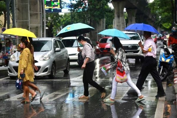
Bangkok battered as deadly monsoon lashes Thailand
Storm-driven winds and dangerous sea swells threaten safety as weather chaos escalates nationwide
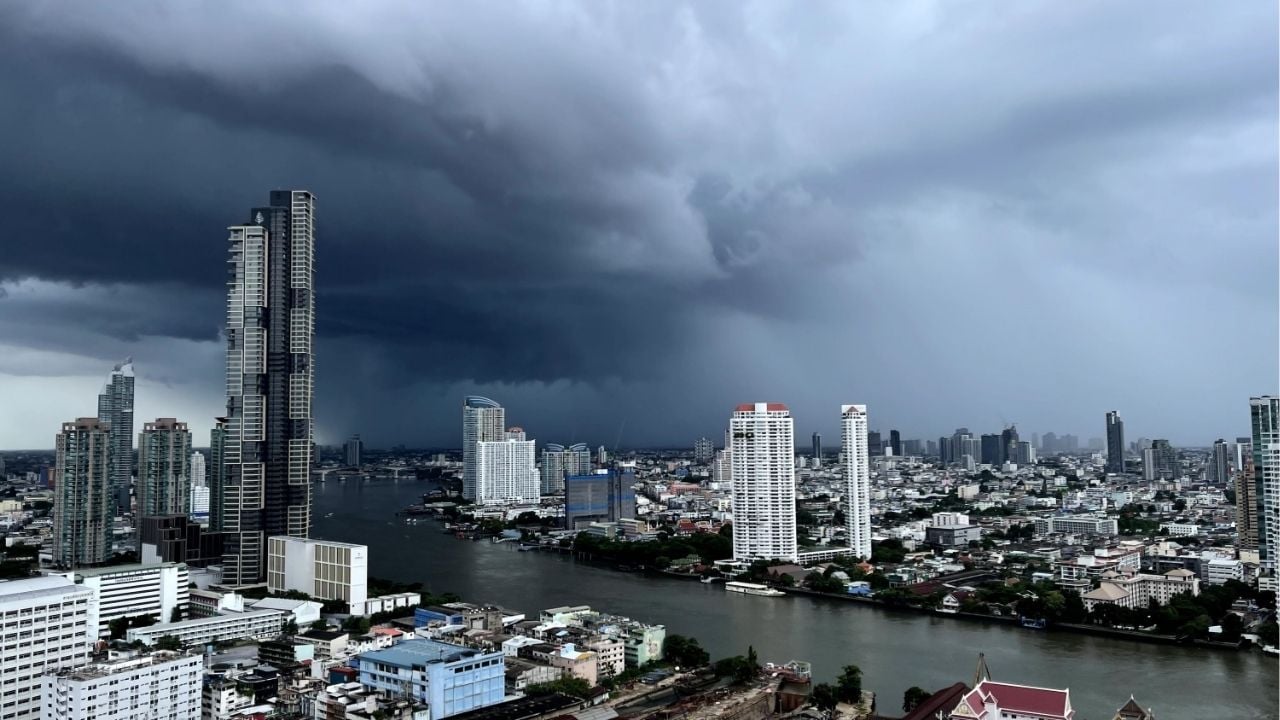
Thailand’s Meteorological Department (TMD) has issued a weather warning for today, forecasting torrential rain, flash floods, and stormy seas across 24 provinces, with Bangkok expected to bear the most severe impact.
The latest 24-hour forecast indicates heavy rainfall will drench the northern, upper northeastern, central, and eastern regions. Areas most at risk include Mae Hong Son, Chiang Mai, Tak, and Kanchanaburi, where residents are urged to stay alert for flash flooding and river overflows.
Driving the mayhem is a strong southwest monsoon blowing across the Andaman Sea, Thailand, and the Gulf of Thailand. A monsoon trough is also drifting across northern Thailand and into a low-pressure zone in northern Vietnam, intensifying the downpours.
Warnings have been issued for dangerous maritime conditions. The upper Andaman Sea and upper Gulf of Thailand are seeing waves of 2–3 metres, while thunderstorm zones could experience even higher surges. The lower Andaman Sea is expecting waves around 2 metres, rising in storm-hit areas.
“Small boats should remain ashore,” officials advised, stressing that high winds and rough waters make sailing perilous for at least another day.
Across the country, thunderstorms and heavy rain are forecast for:
-
Northern Thailand: Chiang Rai, Lamphun, Lampang, and Sukhothai (23–25°C low, 29–32°C high)
-
-
Northeastern provinces: Nong Khai, Bueng Kan, Sakon Nakhon, Nakhon Phanom, and Mukdahan (23–25°C to 32–35°C)
-
Central provinces: Nakhon Sawan, Uthai Thani, Kanchanaburi (25–26°C to 33–35°C)
-
Eastern Thailand: Nakhon Nayok, Prachin Buri, Chanthaburi, and Trat will see 60% thunderstorm coverage and winds up to 40 km/h
-
Southern coastlines:
-
East: Phetchaburi, Prachuap Khiri Khan (20% coverage, 34–36°C highs)
-
West: Ranong, Phang Nga (waves of 2–3 metres and strong winds)
-


Bangkok will see a 60% chance of thunderstorms, with temperatures ranging from 26–27°C to 33–35°C and winds of 10–20 km/h.
KhaoSod reports that in the western Pacific, Typhoon Wipha has dissipated, but three new storms have formed. While none are forecast to affect Thailand, authorities will continue monitoring the situation.
Latest Thailand News


Follow The Thaiger on Google News: