Myanmar rocked by 13 earthquakes in one week
A popular Thai weather monitoring Facebook page has issued a warning about increased seismic activity in Myanmar.
Today, December 3, the page “Tee Lomfah Akat” reported that three earthquakes struck Myanmar overnight from December 2 into the early hours of December 3.
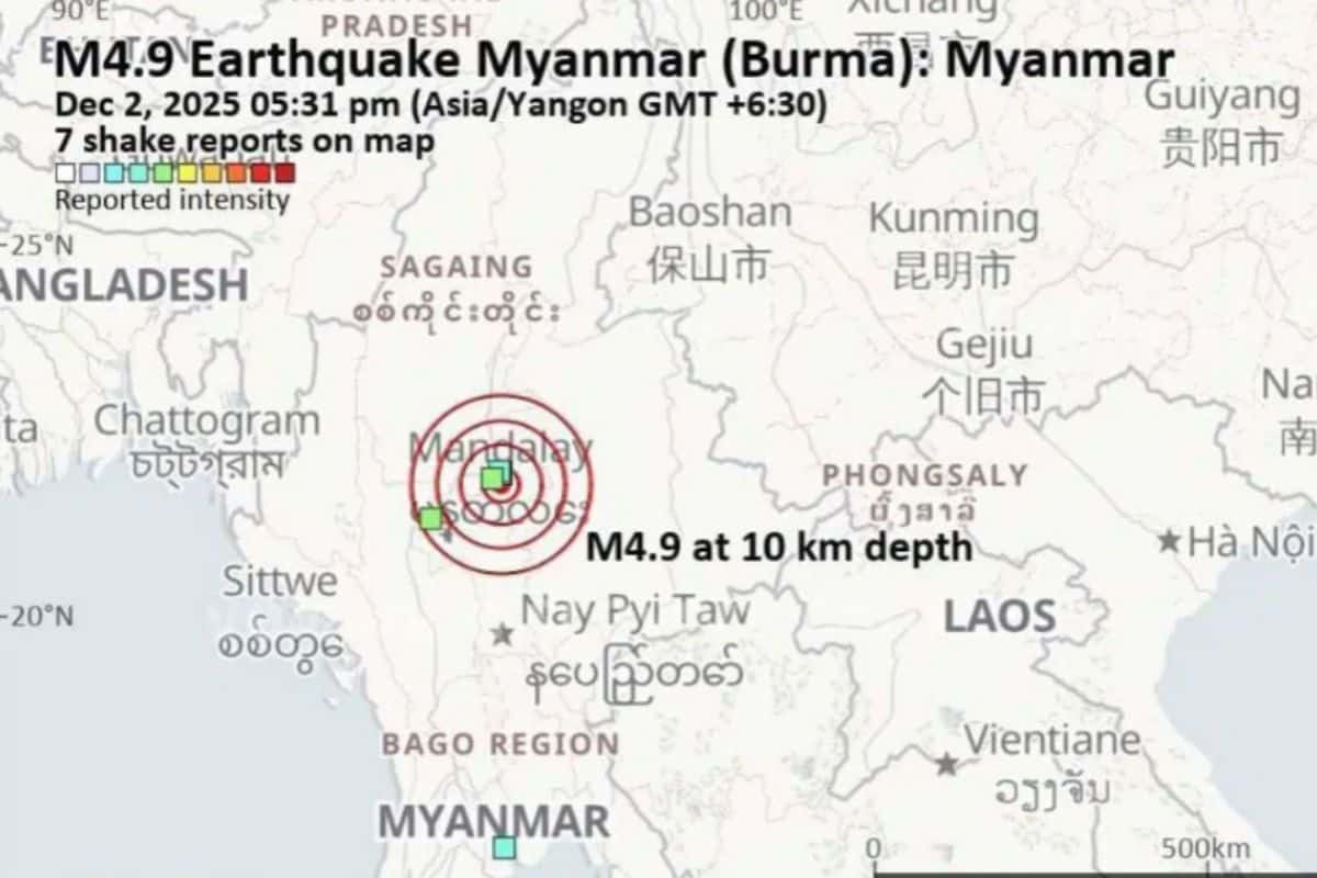
The page reported the earthquake around the Sagaing Fault Line, where a powerful quake earlier this year caused a government building to collapse. The strongest quake measured 4.9 magnitude and hit near Mandalay, along the same fault line that triggered the destructive March 28 earthquake.
The first tremor struck at 6.01pm on December 2, with a magnitude of 4.9 at a depth of 10 kilometres. The page pointed out that this quake originated from the exact location of the March incident, suggesting that seismic activity along the Sagaing Fault is becoming more frequent, though it clarified that this is not yet the main shock.
Two more quakes followed later that night. The second occurred at 11.26pm in Taunggyi, registering 2.2 magnitude at a depth of 10 kilometres. The third hit at 1.50am on December 3 in Mong Khet, with a 3.6 magnitude at the same depth. The page did not report structural damage or surface-level impact.
As of 5.30am on December 3, the page noted that the Sagaing Fault had not released further energy for nearly 12 hours. However, it urged the public to monitor updates closely. While earthquakes cannot be precisely predicted, ongoing geological changes can suggest clues about possible future events.
13 quakes recorded in one week
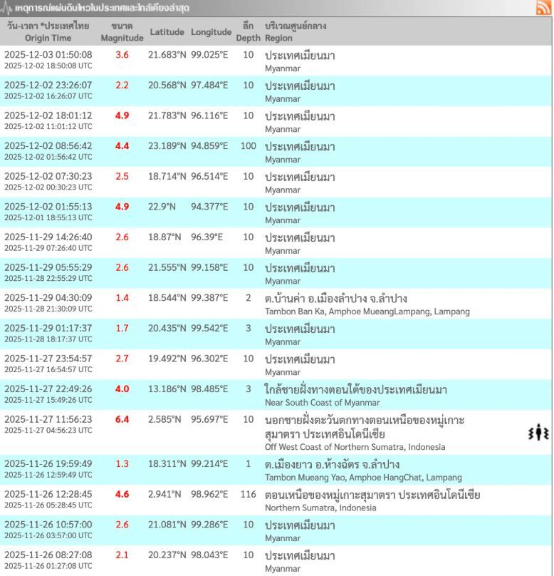
According to Thailand’s Earthquake Surveillance Division, Myanmar experienced five earthquakes on December 2 alone, including two 4.9-magnitude events. The day’s recorded quakes included:


- 1.55am: 4.9 magnitude, 10km depth
- 8.56am: 4.4 magnitude, 100km depth
- 6.01pm: 4.9 magnitude, 10km depth
An aftershock measuring 3.6 magnitude also struck at 1.50am on December 3.
From November 26 to December 3, Myanmar experienced 13 quakes in total:
- December 3: 3.6
- December 2: 2.2, 4.9, 4.4, 2.5, 4.9
- November 29: 2.6, 2.6, 1.7
- November 27: 2.7, 4.0 (southern coastal area)
- November 26: 2.6, 2.1
Most epicentres occurred within Myanmar, and many occurred at shallow depths around 10 kilometres, making them more likely to be felt by local populations. However, no significant cross-border damage has been reported in Thailand so far.
Latest Thailand News


Follow The Thaiger on Google News: