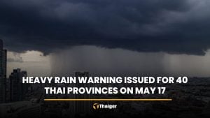
Heavy rainfall and high sea waves expected across Thailand

Monsoons have covered the Andaman Sea and the Gulf of Thailand, leading to heavy rainfall in the north, east, and Bangkok. High sea waves are expected, and sailors are advised to exercise caution.
The Thai Meteorological Department (TMD) weather forecast for the next 24 hours reveals a moderate southwest monsoon is currently covering the Andaman Sea, Thailand, and the Gulf of Thailand. Additionally, a low-pressure area is present over northern Vietnam and the Gulf of Tonkin.
This weather pattern will result in heavy rainfall in the north, northeast, central, and southern regions, with particularly intense rain in some areas of the east. Residents in these regions should be mindful of potential flash floods and overflowing streams, especially in mountainous areas near watercourses and low-lying areas.
Sea conditions in the Andaman Sea and the Gulf of Thailand are expected to be rough. The upper Andaman Sea and the upper Gulf of Thailand will experience waves approximately 2 metres high while the lower Andaman Sea and the lower Gulf of Thailand will see waves ranging from 1 to 2 metres.
In areas with thunderstorms, wave heights could exceed 2 metres. Mariners are advised to navigate cautiously and avoid sailing in stormy regions.
Meanwhile, Typhoon Kemi, currently over the Pacific Ocean, is expected to pass through Taiwan and make landfall on the eastern coast of China between today and tomorrow. This typhoon will not directly affect Thailand’s weather, but travellers to those areas should check the weather conditions before departing.
Heavy rainfall


In the north, 60% of the area will experience thunderstorms, with heavy to very heavy rainfall in Mae Hong Son, Chiang Mai, Chiang Rai, Lamphun, Lampang, Phayao, Nan, Kamphaeng Phet, Tak, Phitsanulok, and Phetchabun. The minimum temperature will be between 24 and 26 degrees Celsius, while the maximum will range from 31 to 34 degrees Celsius. Southwesterly winds will blow at speeds of 10 to 25 kilometres per hour.
In the northeast, 60% of the area will see thunderstorms, with heavy rainfall in Nong Khai, Bueng Kan, Sakon Nakhon, Nakhon Phanom, and Mukdahan. The minimum temperature will range from 24-26 degrees Celsius, and the maximum will be between 30 and 34 degrees Celsius. Southwesterly winds will blow at speeds of 10 to 20 kilometres per hour.
In the central region, 70% of the area will experience thunderstorms, with heavy rainfall in Nakhon Sawan, Uthai Thani, Kanchanaburi, Ratchaburi, Nakhon Pathom, Samut Songkhram, and Samut Sakhon. The minimum temperature will be between 24 and 26 degrees Celsius, and the maximum will range from 32 to 34 degrees Celsius. Southwesterly winds will blow at speeds of 10 to 25 kilometres per hour.
In the east, 60% of the area will have thunderstorms, with heavy to very heavy rainfall in Nakhon Nayok, Prachin Buri, Sa Kaeo, Chon Buri, Rayong, Chanthaburi, and Trat. The minimum temperature will range from 24 to 28 degrees Celsius, and the maximum will be between 31 and 34 degrees Celsius. Southwesterly winds will blow at speeds of 20 to 35 kilometres per hour. Sea waves will be around 2 metres high, and in stormy areas, waves will exceed 2 metres.
In the south (east coast), 40% of the area will experience thunderstorms, with heavy rainfall in Phetchaburi, Prachuap Khiri Khan, Chumphon, and Surat Thani. The minimum temperature will be between 24 and 26 degrees Celsius, and the maximum will range from 31 to 36 degrees Celsius.
From Surat Thani upwards, southwesterly winds will blow at speeds of 15 to 35 kilometres per hour, with sea waves 1 to 2 metres high, and higher in stormy areas. From Nakhon Si Thammarat downwards, southwesterly winds will blow at speeds of 15 to 30 kilometres per hour, with sea waves around 1 metre high, and higher in stormy areas.
In the south (west coast), 40% of the area will see thunderstorms, with heavy rainfall in Ranong, Phangnga, and Phuket. The minimum temperature will be between 25 and 27 degrees Celsius, and the maximum will range from 32 to 34 degrees Celsius.
From Phuket upwards, southwesterly winds will blow at speeds of 20 to 35 kilometres per hour, with sea waves around 2 metres high, and higher in stormy areas. From Krabi downwards, southwesterly winds will blow at speeds of 15 to 35 kilometres per hour, with sea waves 1 to 2 metres high, and higher in stormy areas.
In Bangkok and its vicinity, 70% of the area will have thunderstorms. The minimum temperature will range from 25 to 27 degrees Celsius, and the maximum will be between 32 and 35 degrees Celsius. Southwesterly winds will blow at speeds of 10 to 25 kilometres per hour.
Latest Thailand News


Follow The Thaiger on Google News: