Mae Sai battles floods again as Chiang Rai plans flood prevention

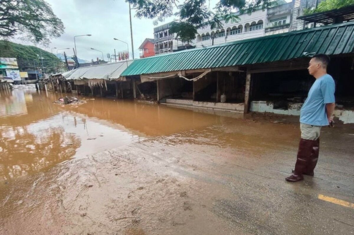
Mae Sai district residents are grappling with the aftermath of severe flooding, only weeks after recovering from the previous inundation during the rainy season.
Torrential rains on Thursday night, November 7, led to the Sai Lom Joy market, positioned along the Sai River, being submerged under floodwater.
Despite the adverse weather conditions, Mueang Daeng Road and Lung Khon Wood Market remained unaffected, as local reports confirmed.
In September, both the Mae Sai and Mueang districts of Chiang Rai province experienced devastating floods. These recurring floods have spurred local authorities into action.
Yesterday, Chotnarin Koedsom, the acting governor of Chiang Rai, spearheaded a crucial meeting with officials from various agencies, including the Provincial Disaster Prevention and Mitigation Office and the Irrigation Office. The focus was on disaster prevention strategies for the Mueang and Mae Sai districts.
The meeting delved into analysing the capacity and flow of major rivers such as the Kok, Lao, Sai, Ruak, and Mekong, drawing data from reports collected between August and September, said Chotnarin,
“The panel reached consensus on several infrastructure initiatives to mitigate flood impact.”
These measures include dredging rivers, building water retention walls, removing encroachments on riverbanks, and implementing enhanced urban planning and construction regulations.
In a separate incident, the Geological Disaster Operation Centre reported that a 4.7-magnitude earthquake struck Myanmar, with vibrations felt in parts of Thailand.
The quake’s tremors, originating from the Mengxing Fault, were observed at 11.30pm last Thursday, October 31. Its epicentre was located in Myanmar’s Shan State, approximately 42 kilometres from Mae Sai district, and occurred 7 kilometres underground.
A subsequent aftershock, measuring 3.5 in magnitude, was recorded at 1.03am yesterday, November 8, at a depth of 10 kilometres underground. The tremors were perceptible across 10 districts in Chiang Rai, including Chiang Khong, Chiang Saen, Mae Fa Luang, Mae Sai, Mae Chan, Wiang Chai, Mueang, Wiang Chiang Rung, Mae Suai, and Doi Luang.
Additionally, the quake was detected in the Fang and Mae Ai districts of Chiang Mai, as well as the Pai district in Mae Hong Son. The full extent of the damage remains unassessed, according to the centre. They have ordered inspections of several archaeological sites in the region to evaluate potential impacts, reported Bangkok Post.
What Other Media Are Saying
- Voice of America highlights Thailand’s devastating floods, exacerbated by climate change and Typhoon Yagi, urging the government to adopt long-term flood management strategies and enhance disaster preparedness for affected communities. (read more)
Frequently Asked Questions
Here are some common questions asked about this news
Why do certain areas in Mae Sai remain unaffected by severe floods?
Geographical elevation and urban planning might shield specific locations from water accumulation, sparing them from flooding impacts.
How could the recurring floods in Chiang Rai influence future urban planning?
Persistent flooding could prompt enhanced infrastructure, stricter building codes, and strategic water management to mitigate future disasters.
What if the proposed infrastructure initiatives in Chiang Rai prove ineffective against floods?
Ineffective measures could necessitate further innovative solutions, potentially involving advanced technologies or international partnerships.
How do earthquakes near Mae Sai impact regional infrastructure and daily life?
Seismic activities might stress structures, necessitating inspections and potentially impacting transportation, housing, and heritage sites.
What measures can be taken to predict and prepare for future seismic events in the region?
Enhanced monitoring systems and public awareness campaigns can improve preparedness and minimise seismic risks.
Latest Thailand News
Follow The Thaiger on Google News:


