Heavy rainfall and flash flood warnings across Thailand

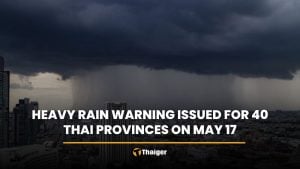
Heavy rainfall is expected across Thailand today, with over 60% coverage in all regions, including Bangkok. The Meteorological Department of Thailand (TMD) warned of potential flash floods and forest runoff due to the intense weather conditions.
The TMD forecasted that the southwest monsoon covering the Andaman Sea, Thailand, and the Gulf of Thailand is relatively strong. This, combined with a monsoon trough passing through northern Thailand and upper Laos, leading to a low-pressure area over northern Vietnam, is causing significant rainfall in many areas of the country.
Thailand will experience heavy to very heavy rainfall in several regions, particularly in the north, northeast, east, and western parts of the south.
Residents in these areas are advised to be cautious of the dangers posed by heavy and accumulated rainfall, which could result in sudden flooding and flash floods, especially in foothill areas near waterways and lowland regions. Additionally, caution while travelling in areas with thunderstorms is advised.
The upper Andaman Sea and upper Gulf of Thailand will have relatively strong wind waves, with waves expected to reach heights of 2 to 3 metres. In areas with thunderstorms, waves could exceed 3 metres.
The upper Gulf of Thailand will have waves of about 2 metres, and in areas with thunderstorms, waves will be higher than two metres. Mariners should exercise caution and avoid sailing in areas with thunderstorms, and it is recommended that small boats in the upper Andaman Sea remain ashore.
Regional updates


In the northern region, thunderstorms are expected in 80% of the area, with heavy to very heavy rainfall in some places such as Mae Hong Son, Chiang Mai, Chiang Rai, Lamphun, Lampang, Phayao, Nan, Uttaradit, Kamphaeng Phet, Phichit, Phitsanulok, Phetchabun, and Tak. Temperatures will range from 23 to 26 degrees Celsius at the minimum and 32 to 35°C at the maximum. The southwest wind will blow at a speed of 10 to 20 kilometres per hour.
In the northeastern region, thunderstorms are expected in 80% of the area, with heavy to very heavy rainfall in some places such as Loei, Nong Khai, Bueng Kan, Nong Bua Lamphu, Udon Thani, Sakon Nakhon, Nakhon Phanom, Mukdahan, Khon Kaen, Nakhon Ratchasima, Roi Et, Yasothon, Amnat Charoen, Sisaket, and Ubon Ratchathani. Temperatures will range from 23 to 25°C at the minimum and 30 to 33°C at the maximum. The southwest wind will blow at a speed of 10 to 20km/h.
In the central region, thunderstorms are expected in 60% of the area, with heavy rainfall in some places such as Nakhon Sawan, Uthai Thani, Chai Nat, Kanchanaburi, Ratchaburi, Lop Buri, and Saraburi. Temperatures will range from 24 to 26°C at the minimum and 32 to 35 °C at the maximum. The southwest wind will blow at a speed of 10 to 25km/h.
In the eastern region, thunderstorms are expected in 70% of the area, with heavy to very heavy rainfall in some places such as Nakhon Nayok, Prachin Buri, Sa Kaeo, Chachoengsao, Chanthaburi, and Trat. Temperatures will range from 24 to 28°C at the minimum and 28 to 34°C at the maximum. The southwest wind will blow at a speed of 20 to 35km/h. The sea will have waves of about 2 metres, and in areas with thunderstorms, waves will be higher than 2 metres.
In the southern region (east coast), thunderstorms are expected in 60% of the area, with heavy rainfall in some places such as Phetchaburi, Prachuap Khiri Khan, Chumphon, Surat Thani, Nakhon Si Thammarat, and Phatthalung. Temperatures will range from 23 to 27°C at the minimum and 31 to 34°C at the maximum.
From Surat Thani upwards, the southwest wind will blow at a speed of 20 to 35km/h. The sea will have waves of about 2 metres, and in areas with thunderstorms, waves will be higher than 2 metres. From Nakhon Si Thammarat downwards, the southwest wind will blow at a speed of 15 to 35km/h. The sea will have waves of 1 to 2 metres, and in areas with thunderstorms, waves will be higher than 2 metres.
Thunderstorms expected
In the southern region (west coast), thunderstorms are expected in 70% of the area, with heavy to very heavy rainfall in some places such as Ranong, Phang Nga, Phuket, and Krabi. Temperatures will range from 23 to 25°C at the minimum and 29 to 32°C at the maximum.
From Phang Nga upwards, the southwest wind will blow at a speed of 20 to 40km/h. The sea will have waves of 2 to 3 metres, and in areas with thunderstorms, waves will be higher than 3 metres. From Phuket downwards, the southwest wind will blow at a speed of 15 to 35km/h. The sea will have waves of 1 to 2 metres, and in areas with thunderstorms, waves will be higher than 2 metres.
In Bangkok and its vicinity, thunderstorms are expected in 60% of the area, with heavy rainfall in some places. Temperatures will range from 26 to 28°C at the minimum and 32 to 35°C at the maximum. The southwest wind will blow at a speed of 10 to 25km/h.
Latest Thailand News


Follow The Thaiger on Google News: