Chiang Mai braces for potential flooding as water levels rise
Urgent warnings from the Chiang Mai Irrigation Office have been issued regarding the expected rise in water levels at Nawarat Bridge. The water is predicted to peak at approximately 4.45 metres early tomorrow morning.
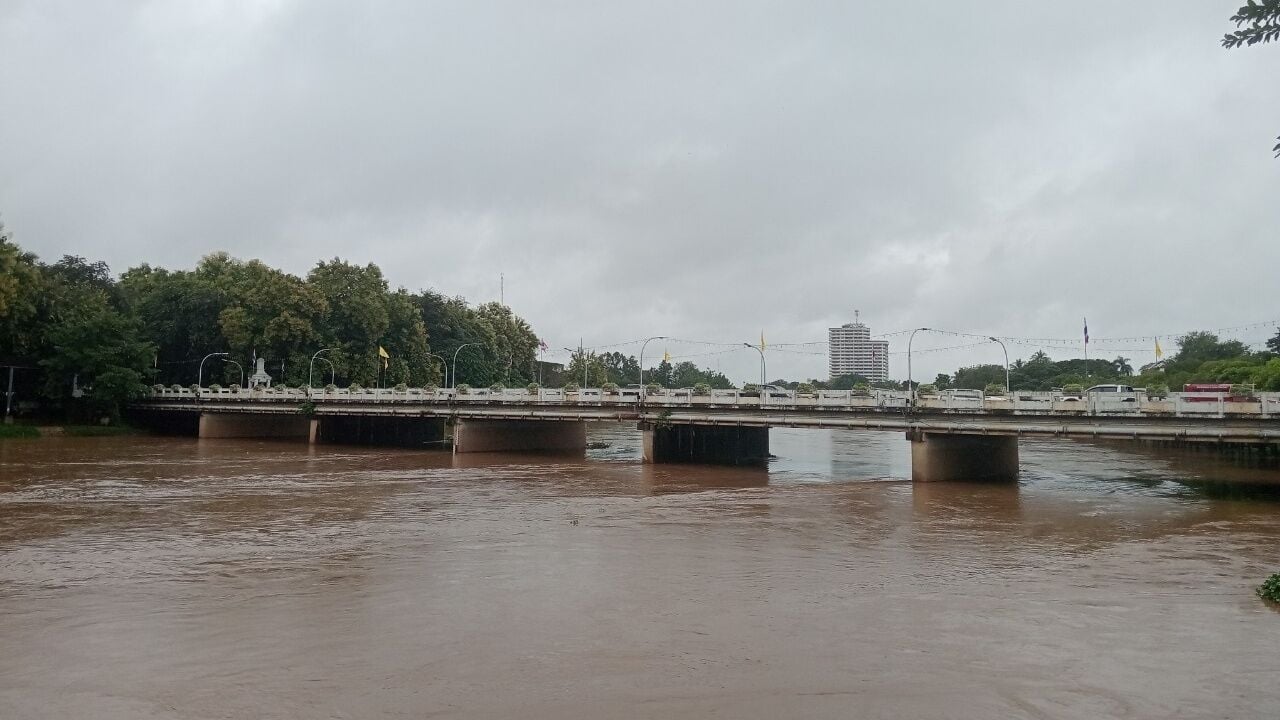
The Chiang Mai Irrigation Office 1 announced today, September 25, that due to the influence of Typhoon Surigae, significant rainfall from three days ago has caused a dramatic rise in water levels in the Ping River and its tributaries. The office anticipates that the water level could exceed the riverbanks in the municipal area of Chiang Mai, particularly at station P.1, Nawarat Bridge.
As of 5pm today, the water level at Nawarat Bridge was recorded at 3.70 metres, which is at a critical level, with a flow rate of 405 cubic metres per second. The water flow from the upper Ping River basin, including sources from Chiang Dao, Mae Taeng, Mae Rim, and Mae Tao Hai, continues to increase.
At Chiang Dao, the water level peaked at 4.61 metres with a flow rate of 3,122.595 cubic metres per second at 2pm today. Water from Mae Taeng and Mae Rim is steadily flowing into the Ping River, causing a slight increase in water levels.
The irrigation office forecasts that the water level at station P.67 in Ban Mae Ta, San Sai district, will peak at approximately 490 cubic metres per second between 9pm and 10pm tonight. This mass of water is expected to reach Nawarat Bridge at its highest level, around 4.45 metres, by 3am to 5am tomorrow, assuming no additional rainfall in the upper basin.
The Chiang Mai Irrigation Office 1 will closely monitor the situation and provide continuous updates. Residents in low-lying areas along the Ping River are advised to prepare for potential flooding. Areas identified as flood-prone from last year’s survey include:
Water level


1. Zone 1: With water levels at Nawarat Bridge rising to +3.70 metres, areas like Ban Pa Prao Nok (partially), riverside restaurants, and the underpass beneath Pa Daet Bridge are at risk.
2. Zone 2: At +3.90 metres, Charoen Prathet Road, Chiang Mai Forestry, Montfort Primary School, Chai Mongkol Temple, Ban Pa Prao Nok, and Wiang Thong Village could be affected.
3. Zone 3: At +4.00 metres, Ban Den, Chiang Mai Provincial Electricity Authority (Ban Den), and Jindanivet Village are likely to experience flooding.
4. Zone 4: At +4.10 metres, Rimping Supermarket, Tha Satoi Temple, Thong Kam Market, Kawila Camp, Kong Sai Road, and San Pa Koi Market (partially) are at risk.
5. Zone 5: At +4.20 metres, Nong Hoi Market, Ko Klang Road, Montfort Secondary School, Kawila School, Muang Sat Luang Temple, Muang Sat Noi Temple, Palm Springs Village, Muang Kai Temple, and Ratchadutis Road could be inundated.
6. Zone 6: At +4.30 metres, Chang Klan Road, the Night Bazaar, the Saeng Tawan intersection, and Hua Fai Temple are anticipated to be affected.
In preparation, the irrigation office has instructed relevant agencies to:
1. Closely monitor the water situation.
2. Inspect and reinforce riverbank protection structures, especially in low-lying areas.
3. Prepare machinery and tools for immediate assistance to mitigate the impact on the public.
4. Publicise information and warn residents living outside permanent flood defences and in low-lying areas in advance.
This announcement was made at 6pm yesterday, reported KhaoSod.
Latest Thailand News


Follow The Thaiger on Google News: