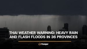
Thailand dodges storm Matmo but rain lashes regions
Forecast warns of rough seas, strong winds, and widespread rain


Follow The Thaiger on Google News:
A severe tropical storm is currently churning over the upper South China Sea and expected to intensify before making landfall in upper Vietnam between October 5 and 6.
Tropical storm Matmo, classified as severe, is currently swirling over the upper South China Sea. The storm is expected to intensify further as it moves past Hainan, China, before making landfall over upper Vietnam between tomorrow, October 5, and Monday, October 6. Thai authorities confirm the system will not enter Thailand, though it may contribute to unstable weather across the region.
Despite avoiding a direct hit, Thailand remains under a watchful eye as southerly and southeasterly winds continue to dominate the northeast, east, parts of the central region, and the Gulf of Thailand. Meanwhile, a weak southwest monsoon prevails over the Andaman Sea and the western part of the country, fuelling widespread rain.

The weather forecast for 6am today, October 4, to 6am tomorrow is as follows:
In the North, scattered thundershowers are likely in provinces including Mae Hong Son, Chiang Mai, Sukhothai, Tak, Kamphaeng Phet, Phichit, Phitsanulok and Phetchabun. Temperatures will range from 22 to 26°C in the morning, climbing to 33 to 35°C during the day. Winds are expected to be light, between 5 and 10 km/hr.
Northeastern Thailand will also see scattered thundershowers, particularly in Loei, Nong Khai, Bueng Kan, Sakon Nakhon, Nakhon Phanom, Nong Bua Lamphu, Chaiyaphum, Khon Kaen, Nakhon Ratchasima, Buriram, Surin, Sisaket and Ubon Ratchathani. Temperatures are forecast to be between 22 and 26°C minimum, and 31 to 34°C maximum, with southeasterly winds blowing at 10 to 20 km/hr.
The central region, including Bangkok and its vicinity, will experience fairly widespread thundershowers with isolated heavy rain, particularly in Phra Nakhon Si Ayutthaya, Kanchanaburi, Ratchaburi, Nakhon Pathom, Samut Sakhon and Samut Songkhram. Morning temperatures will fall between 23 and 26°C, rising to highs of 31 to 34°C. Winds will be southeasterly at 10 to 20 km/hr.

In the East, residents in Chon Buri, Rayong, Chanthaburi and Trat can expect similar weather, with fairly widespread thundershowers and isolated heavy rain. Minimum temperatures will range from 23 to 25°C, with daytime highs reaching 30 to 33°C. Southeasterly winds will be stronger here, between 10 and 30 km/hr. Wave heights in the Gulf are estimated at around 1 metre, rising to more than 2 metres during thundershowers.
The southern east coast, including provinces such as Phetchaburi, Prachuap Khiri Khan, Chumphon, Surat Thani and Nakhon Si Thammarat, will experience scattered thundershowers. Temperatures will range from 22 to 25°C in the early hours, with highs of 33 to 35°C. Winds will blow northwesterly at 15 to 30 km/hr, and wave heights are expected to be about 1 metre, climbing to over 2 metres in areas of heavy rain.
On the west coast, scattered thundershowers are expected in Ranong, Phang Nga, Krabi and Trang. Minimum temperatures will dip to between 22 and 24°C, while daytime temperatures will rise to 31 to 33°C. Northwesterly winds will sweep through at 15 to 30 km/hr. Wave conditions will mirror those on the Gulf side, with sea levels at 1 metre and exceeding 2 metres in storm-affected areas, according to the Thai Meteorological Department.
Bangkok will see scattered thundershowers with isolated heavy downpours. Morning temperatures will be around 23 to 25°C, with daytime highs soaring to between 33 and 35°C. Southeasterly winds will blow at 10 to 20 km/hr.
Officials urge residents in affected regions to remain cautious, especially near hillsides and low-lying areas where flash floods may occur. All boats are advised to proceed with care and avoid sailing near thundershowers.
Follow The Thaiger on Google News: