Thai weather warning: Northeast bracing for strong winds

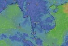
The Meteorological Department of Thailand (TMD) issued a Thai weather warning today, indicating a drop in temperatures and strong winds, particularly in the northeastern region. The southern part of Thailand is bracing for heavy rainfalls and high sea waves, posing potential risks of sudden flooding and forest runoffs.
An incoming mass of cold air from China is expected to cover parts of North Vietnam and the South China Sea. It’s anticipated to move into the upper northeast region of Thailand today, resulting in a drop in temperature and winds picking up pace.
This shifting Thai weather pattern calls for citizens to be vigilant about health issues that could arise from the changing Thai weather, as well as potential fire hazards due to dry conditions.
The northeastern monsoon is intensifying over the Gulf of Thailand and the southern region. Accompanied by a low-pressure area covering the South China Sea, it is likely to pass through the Gulf of Thailand.
Consequently, the lower southern region (eastern side), will continue to experience heavy rainfall in several areas. The Gulf of Thailand will also see increased wind intensity. The lower Gulf of Thailand is forecasted to have waves as high as 2 to 3 metres, and regions with thunderstorms can witness waves exceeding 3 metres.
The upper Gulf of Thailand is expected to have waves between 1 to 2 metres, with areas having thunderstorms experiencing waves exceeding 2 metres. The Andaman Sea is predicted to have waves approximately 1 metre high, with areas having thunderstorms experiencing waves exceeding 2 metres.
Heavy rainfall

Residents of the lower southern region are advised to be cautious of heavy rainfall and accumulated rain which could lead to sudden flooding and forest runoffs. This is particularly important for areas near mountain slopes, waterways and low-lying areas.
Mariners are advised to navigate with caution, avoiding areas with thunderstorms. Small boats in the lower Gulf of Thailand should remain ashore during this period. Additionally, caution should be exercised for strong waves crashing towards the shore.
The weather forecast for Thailand from today 6am to tomorrow 6am expects the northern region to experience cool weather in the morning with light rain in some areas, mostly in the upper part of the region. The lowest temperature is predicted to be between 17 to 20 degrees Celsius, with the highest temperature between 30 to 34 degrees Celsius.
Peak mountain areas will experience cold to quite cold weather with the lowest temperature between 9 to 16 degrees Celsius. Winds from the northeast are expected to be between 5 to 15 kilometres per hour.
The northeastern region will experience cool weather in the morning with strong winds. The temperature is expected to drop by 1 to 2 degrees Celsius, with light rain in some areas, mainly in the upper part of the region. The lowest temperature is predicted to be between 17 to 21 degrees Celsius, with the highest temperature between 31 to 34 degrees Celsius.
Mountain peaks will experience cold to quite cold weather with the lowest temperature between 11 to 16 degrees Celsius. Winds from the northeast are expected to be between 15 to 30 kilometres per hour.
Cool weather
Central Thailand will experience cool weather in the morning with the lowest temperature between 20 to 23 degrees Celsius, and the highest temperature between 32 to 33 degrees Celsius. Winds from the northeast are expected to be between 10 to 30 kilometres per hour, reported KhaoSod.
Eastern Thailand will experience cool weather in the morning with the lowest temperature between 22 to 24 degrees Celsius, and the highest temperature between 33 to 35 degrees Celsius. Winds from the northeast are expected to be between 15 to 30 kilometres per hour.
The sea is expected to have waves of about 1 metre, while areas with thunderstorms can expect waves exceeding 2 metres.
The southern region (east coast) will experience thunderstorms with 40% of the area expected to have heavy to very heavy rainfall, especially in Surat Thani, Nakhon Si Thammarat, Pattalung, Songkhla, Pattani, Yala, and Narathiwat. The lowest temperature is expected to be between 22 to 25 degrees Celsius, and the highest temperature is between 29 to 33 degrees Celsius.
From Chumphon upwards, winds from the northeast are expected to be between 15 to 35 kilometres per hour. The sea is expected to have waves of about 1 to 2 metres, while areas with thunderstorms can expect waves exceeding 2 metres.
From Surat Thani downwards, winds from the east are expected to be between 20 to 40 kilometres per hour. The sea is expected to have waves of about 2 to 3 metres, while areas with thunderstorms can expect waves exceeding 3 metres.
Thunderstorms
The southern region (west coast) will experience thunderstorms with 40% of the area expected to have heavy rainfall, especially in Krabi, Trang, and Satun. The lowest temperature is expected to be between 24 to 26 degrees Celsius, and the highest temperature is between 31 to 33 degrees Celsius.
Winds from the northeast are expected to be between 15 to 30 kilometres per hour. The sea is expected to have waves of about 1 metre, while areas with thunderstorms can expect waves exceeding 2 metres.
Bangkok and its vicinity will have partly cloudy weather with the lowest temperature between 24 to 25 degrees Celsius, and the highest temperature between 33 to 35 degrees Celsius. Winds from the northeast are expected to be between 10 to 30 kilometres per hour.
Latest Thailand News


Follow The Thaiger on Google News: