Thailand braces for severe weather as storms hit 17 provinces

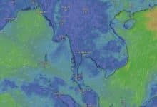
A powerful weather front is currently affecting Thailand, with the Meteorological Department of Thailand (TMD) issuing a severe weather warning for 17 provinces. Eastern regions are expected to bear the brunt of the storm, with 30% of the area predicted to experience heavy thunderstorms, strong gusts of wind, and possible hail.
The warning comes as a new high-pressure system from China covers the upper part of Vietnam and is forecast to extend its influence over the northeastern part of Thailand today.
Areas in the lower northeast, and the lower central region, including Bangkok and its vicinities, the east, and the upper south, are affected by a combination of southerly and southeasterly winds. This convergence is causing thunderstorms with strong winds and hail in some areas initially, followed by a temperature drop.
Residents in the northeastern and eastern regions are advised to be cautious of the dangers posed by thunderstorms, strong gusts, hail, and lightning. Staying clear of open fields, large trees, and unstable billboards is recommended.
The northeastern monsoon over the Gulf of Thailand and the south is intensifying, leading to thunderstorms in some southern areas and waves up to 2 metres high in the lower Gulf of Thailand. Fishermen in the Gulf are advised to navigate with caution and avoid areas with thunderstorms where waves can exceed 2 metres, reported KhaoSod.
Dust particles have accumulated in the upper part of Thailand from moderate to high levels due to the weak wind cover, while the accumulation in Bangkok, its vicinities, and the East is from low to moderate levels, influenced by the southerly and southeasterly winds.
Thunderstorms
In the northeast, 20% of the area may face thunderstorms with strong winds and hail, particularly in the provinces of Chaiyaphum, Khon Kaen, Nakhon Ratchasima, Buriram, Surin, Sisaket, and Ubon Ratchathani. Temperatures could fall by 2-4 degrees Celsius, accompanied by strong winds, with a minimum of 15-20 degrees Celsius and a maximum of 31-36 degrees Celsius. Mountainous areas will be cold, with temperatures dropping to 11-16 degrees Celsius.

The central region will experience morning fog and daytime heat, with temperatures ranging from 22-25 degrees Celsius at the lowest to 35-39 degrees Celsius at the highest. The east is set to have thunderstorms in 30% of the area, with strong gusts and hail in some parts, particularly in the provinces of Chachoengsao, Nakhon Nayok, Prachinburi, and Sa Kaeo, with temperatures between 24-27 degrees Celsius at the lowest and 33-36 degrees Celsius at the highest.
For the southern region on the east coast, 20% of the area is likely to experience thunderstorms, mainly in the provinces of Surat Thani, Nakhon Si Thammarat, and Phatthalung, with temperatures from 23-25 degrees Celsius at the lowest to 32-36 degrees Celsius at the highest. The west coast of the south will have partly cloudy skies and hot daytime weather, with a 10% chance of thunderstorms, mainly in Phang Nga, Phuket, and Krabi, with temperatures from 24-25 degrees Celsius at the lowest to 34-37 degrees Celsius at the highest.
Bangkok and its vicinities will face morning fog and daytime heat, with temperatures ranging from 25-27 degrees Celsius at the lowest to 33-37 degrees Celsius at the highest. The public is urged to stay vigilant and follow updates from the TMD as the weather situation develops.
Stay updated on the Thailand weather news with The Thaiger
Latest Thailand News


Follow The Thaiger on Google News: