Today’s weather: Northern Thailand cools down

Weather conditions across the northern region of Thailand today experienced a dip in temperatures by 1 to 2 degrees Celsius. The peaks of the mountains were particularly cold, with temperatures dropping to 4 degrees. The lowest temperature in Bangkok was 22 degrees.
This weather change is due to a high-pressure system and another wave of cold air mass from China covering the northeastern part and the South China Sea, while the western wind at the upper level continues to blow over the upper northern region.
These conditions resulted in cooler temperatures in the upper northern region of Thailand, with wind gusts in the northeastern region. The northern and northeastern regions experienced cold to cool weather in the morning. The central, eastern, and upper southern regions were cool in the morning.
The mountain peaks in the northern region had cold to very cold weather with frost in some areas, with the lowest temperatures ranging between 4 and 10 degrees Celsius. The mountain peaks in the northeastern region were cold, with the lowest temperatures between 10 and 15 degrees Celsius.
People in Thailand are advised to take care of their health due to the continuing cool weather in the morning during this period, reports Sanook.
The northeastern monsoon covering the Gulf of Thailand and the South has intensified. This has caused the lower southern region to experience isolated thunderstorms. The waves in the Gulf of Thailand and the Andaman Sea are moderate.
Thunderstorms

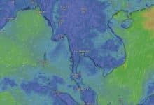
In the lower Gulf of Thailand, the sea has waves about 2 metres high. The upper Gulf of Thailand has waves 1 to 2 metres high. Areas with thunderstorms have waves higher than 2 metres. The Andaman Sea has waves about 1 metre high.
Areas with Thunderstorms offshore have waves higher than 1 metre. Boat operators in these areas should navigate with caution and avoid areas with thunderstorms.
In the meantime, the upper region of Thailand has a moderate accumulation of dust particles and smog due to the increasing strength of the wind and moderate air ventilation.
The northern region will experience cold to cool weather with fog in the morning. The temperature will decrease by 1 to 2 degrees Celsius, with the lowest temperature between 13 and 18 degrees Celsius and the highest between 29 and 34 degrees Celsius.
The mountain peaks will experience very cold weather with frost in some areas, with the lowest temperature between 4 and 10 degrees Celsius. Winds will be from the northeast, with a speed of 5 to 15 kilometres per hour.
The northeastern region will experience cold to cool weather in the morning with strong winds. The temperature will decrease by 1 to 2 degrees Celsius, with the lowest temperature between 14 and 19 degrees Celsius and the highest between 30 and 33 degrees Celsius.
Mountain peaks
The mountain peaks will be cold, with the lowest temperature between 10 and 15 degrees Celsius. Winds will be from the northeast, with a speed of 10 to 30 kilometres per hour.
The central region will experience cool weather in the morning. The temperature will decrease by 1 to 2 degrees Celsius, with the lowest temperature between 19 and 22 degrees Celsius and the highest between 33 and 35 degrees Celsius. Winds will be from the northeast, with a speed of 10 to 25 kilometres per hour.
The eastern region will experience cool weather in the morning in the upper part of the region. The temperature will decrease by 1 to 2 degrees Celsius, with the lowest temperature between 19 and 25 degrees Celsius and the highest between 33 and 36 degrees Celsius.
Winds will be from the northeast, with a speed of 15 to 30 kilometres per hour. The sea will have waves less than 1 metre high, with offshore waves about 1 metre high.
The upper part of the southern region on the East Coast will be cool in the morning. The lowest temperature will be between 20 and 23 degrees Celsius, and the highest will be between 31 and 35 degrees Celsius.
The lower part of the region will experience isolated thunderstorms with 20% of the area, mainly in the provinces of Nakhon Si Thammarat, Phatthalung, Songkhla, Yala, and Narathiwat, experiencing rain.
Low temperatures
The lowest temperature will be between 23 and 26 degrees Celsius, and the highest will be between 31 and 34 degrees Celsius. Winds will be from the northeast, with a speed of 15 to 35 kilometres per hour.
The sea will have waves 1-2 metres high, with areas with thunderstorms having waves higher than 2 metres.
The southern region on the West Coast will experience isolated thunderstorms, with 10% of the area, mainly in the provinces of Phang Nga and Krabi, experiencing rain.
The lowest temperature will be between 23 and 26 degrees Celsius, and the highest will be between 32 and 34 degrees Celsius. Winds will be from the northeast, with a speed of 15 to 30 kilometres per hour.
The sea will have waves about 1 metre high, with offshore areas and areas with thunderstorms having waves higher than 1 metre.
Bangkok and its vicinity will be cool in the morning. The temperature will slightly decrease. The lowest temperature will be between 22 and 25 degrees Celsius, and the highest will be between 33 and 35 degrees Celsius. Winds will be from the northeast, with a speed of 10 to 25 kilometres per hour.
Latest Thailand News


Follow The Thaiger on Google News: