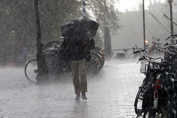
Thai weather alert: Monsoon brings heavy rain and thunderstorms across the nation
An intense Thai weather monsoon, accompanied by low atmospheric pressure, is forecasted to sweep across the northern and upper northeastern regions of Thailand and extend its reach to the upper shores of Vietnam. The western monsoon is also expected to cover the Andaman Sea, lower northeastern region, central region, eastern region, southern region, and the Gulf of Thailand, causing continuous rainfall and heavy downpours in certain areas.
The Thai Meteorological Department warns residents in the affected regions to be vigilant of hazards from heavy rainfall and accumulated rain which may cause flash floods and forest runoff, particularly in sloping areas near waterways and lowland areas. Extra caution is advised when travelling through areas affected by thunderstorms.
Wave heights in the upper Andaman Sea, starting from Ranong province, are predicted to be 1-2 metres high. In areas affected by thunderstorms, waves are expected to exceed 2 metres. The lower Andaman Sea, starting from Phang Nga province, and the Gulf of Thailand are expected to have wave heights of about 1 metre, and 1-2 metres in thunderstorm areas. Boat operators in these areas are advised to navigate with caution and avoid areas affected by thunderstorms.
The Thai weather forecast from midnight today to midnight tomorrow is as follows:
In the north, 80% of the area is expected to experience thunderstorms and heavy rain in certain areas, particularly in provinces such as Mae Hong Son, Chiang Mai, Chiang Rai, Lampoon, Lampang, Nan, Uttaradit, Sukhothai, Tak, Kamphaeng Phet, Phitsanulok, and Phetchaboon. Minimum temperatures are expected to range from 23-25 degrees Celsius and maximum temperatures from 29-33 degrees Celsius, with variable winds at speeds of 10-20 kilometres per hour.
In the northeast, 70% of the area is expected to experience thunderstorms and heavy rain in certain areas, particularly in provinces such as Loei, Nong Khai, Bueng Kan, Nong Bua Lamphu, Udon Thani, Sakon Nakhon, Nakhon Phanom, Mukdahan, Amnat Charoen, and Ubon Ratchathani. Minimum temperatures are expected to range from 23-25 degrees Celsius and maximum temperatures from 32-34 degrees Celsius, with variable winds at speeds of 10-20 kilometres per hour.
In the central region, 70% of the area is expected to experience thunderstorms and heavy rain in certain areas, particularly in provinces such as Nakhon Sawan, Uthai Thani, Saraburi, Suphan Buri, Phra Nakhon Si Ayutthaya, Kanchanaburi, Ratchaburi, Nakhon Pathom, Samut Songkhram, and Samut Sakhon. Minimum temperatures are likely to range from 23-25 degrees Celsius and maximum temperatures from 33-34 degrees Celsius, with southwesterly winds at speeds of 10-20 kilometres per hour.


In the east, 60% of the area is expected to experience thunderstorms and heavy rain in certain areas, particularly in provinces such as Nakhon Nayok, Prachin Buri, Chanthaburi, and Trat. Minimum temperatures are expected to range from 24-28 degrees Celsius and maximum temperatures from 31-34 degrees Celsius, with southwesterly winds at speeds of 15-30 kilometres per hour. The sea is expected to have wave heights of about 1 metre and 1-2 metres in thunderstorm areas.
In the south (east coast), 40% of the area is expected to experience thunderstorms, mostly in provinces such as Phetchaburi, Surat Thani, Nakhon Si Thammarat, Patthalung, Songkhla, Pattani, Yala, and Narathiwat. Minimum temperatures are likely to range from 23-27 degrees Celsius and maximum temperatures from 32-35 degrees Celsius, with southwesterly winds at speeds of 15-30 kilometres per hour. The sea is expected to have wave heights of about 1 metre and 1-2 metres in thunderstorm areas.
In the south (west coast), 40% of the area is expected to experience thunderstorms, mostly in provinces such as Ranong, Phang Nga, Phuket, and Krabi. Minimum temperatures are expected to range from 23-25 degrees Celsius and maximum temperatures from 32-34 degrees Celsius.
From Ranong province upwards, southwesterly winds are expected at speeds of 15-35 kilometres per hour. The sea is expected to have wave heights of 1-2 metres and more than 2 metres in thunderstorm areas. From Phang Nga province downwards, southwesterly winds are expected at speeds of 15-30 kilometres per hour. The sea is expected to have wave heights of about 1 metre and 1-2 metres in thunderstorm areas.
In Bangkok and its vicinity, 70% of the area is expected to experience thunderstorms and heavy rain in certain areas. Minimum temperatures are likely to range from 24-26 degrees Celsius and maximum temperatures from 33-34 degrees Celsius, with southwesterly winds at speeds of 10-20 kilometres per hour.
Follow our latest stories on our new Facebook page: CLICK HERE.
Latest Thailand News


Follow The Thaiger on Google News: