Thai weather update: Heavy rain and storms expected across multiple regions

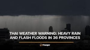
The Thai Meteorological Department warns of heavy to very heavy rainfall across Thailand and the potential for strong storms until September 6. The announcement further warns of flash floods and forest runoff, with high waves expected at sea on September 5.
A strong monsoon trough is currently sweeping through the northern, northeastern, and upper central regions of Thailand, combined with a moderately strong southwest monsoon prevailing over the Andaman Sea, Thailand, and the Gulf of Thailand. This weather pattern is causing heavy to very heavy rainfall in some areas of the country.
Residents in affected areas are urged to take caution due to the risk associated with heavy to very heavy rainfall and accumulated rainfall, which could lead to flash flooding and forest runoff. This is particularly important for areas near hill slopes and waterways as well as low-lying areas. Furthermore, caution should be exercised when travelling through areas experiencing thunderstorms.
The provinces expected to experience heavy to very heavy rainfall in some areas on September 5 include:
Northern region: Mae Hong Son, Phayao, Nan, Phrae, Uttaradit, Sukhothai, Tak, Kamphaeng Phet, Phitsanulok, Phichit, and Phetchabun.
Northeastern region: Loei, Nong Khai, Bueng Kan, Nong Bua Lamphu, Udon Thani, Sakon Nakhon, Nakhon Phanom, Chaiyaphum, Khon Kaen, Kalasin, Mukdahan, Yasothon, Amnat Charoen, and Ubon Ratchathani.
Central region: Uthai Thani, Chai Nat, Sing Buri, Lop Buri, Saraburi, Ayutthaya, Suphan Buri, Kanchanaburi, and Ratchaburi.


Eastern region: Nakhon Nayok, Prachin Buri, Sa Kaeo, Chanthaburi, and Trat.
Southern region: Chumphon, Surat Thani, Nakhon Si Thammarat, Songkhla, Yala, Narathiwat, Ranong, Phang Nga, Phuket, Krabi, Trang, and Satun.
On September 6, the provinces expected to experience heavy to very heavy rainfall in some areas are:
Northern region: Mae Hong Son, Phayao, Nan, Phrae, Uttaradit, Sukhothai, Tak, Kamphaeng Phet, Phitsanulok, Phichit, and Phetchabun.
Northeastern region: Loei, Nong Khai, Bueng Kan, Nong Bua Lamphu, Udon Thani, Sakon Nakhon, Nakhon Phanom, Chaiyaphum, Khon Kaen, Kalasin, Mukdahan, Yasothon, Amnat Charoen, and Ubon Ratchathani.
Central region: Uthai Thani, Kanchanaburi, and Ratchaburi.
Eastern region: Nakhon Nayok, Prachin Buri, Sa Kaeo, Chanthaburi, and Trat.
Southern region: Ranong, Phang Nga, and Phuket.
In the upper Andaman Sea and the upper Gulf of Thailand, the wind is moderately strong with waves 2-3 metres high. In areas with thunderstorms, waves could be higher than 3 metres. In the lower Andaman Sea and the lower Gulf of Thailand, waves are 1-2 metres high and in areas with thunderstorms, waves could be higher than 2 metres.
Mariners in these areas are advised to navigate with caution and avoid areas with thunderstorms. Small boats in the upper Andaman Sea and the upper Gulf of Thailand should remain ashore.
Stay updated on Thai weather news.
Follow more of The Thaiger’s latest stories on our new Facebook page: CLICK HERE.
Latest Thailand News


Follow The Thaiger on Google News: