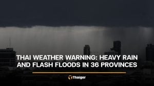
Heavy rain, floods, and landslide dangers as monsoon air currents persist in Thailand

Thailand continues to experience heavy rainfall in various regions due to eastward-moving monsoon air currents and southwestern monsoon winds that still cover the Andaman Sea, Thailand, and the Gulf of Thailand. The adverse weather conditions have resulted in the need for vigilance against potential danger from intense and accumulated rainfall, which might lead to sudden floods and landslides, particularly in steep terrain near watercourses and low-lying areas.
The passing waves from the eastern monsoon previously blanketed Thailand before heading towards the Andaman Sea. This pattern, coupled with a southwestern monsoon, causes isolated heavy rainfall in various regions, including the northern region, the central region, and the western side of the southern region. Inhabitants of these areas are therefore advised to stay alert for potential hazards caused by heavy rainfall and accumulated downpours, which may result in flash floods and wild water flow, especially in hillside areas near waterways and lowlands.
Seafarers from the Andaman Sea and Gulf of Thailand are cautioned about calibrating their seafaring activities. The sea conditions are projected to present wave heights of about 1 metre. In areas subject to thunderstorms, the wave heights may peak at over 2 metres. Seafaring folks, particularly in the fluctuating monsoon regions, are advised to navigate their vessels with caution and avoid areas prone to thunderstorms, reported Sanook.
As for weather forecasts for today and the next day, they break down as follows:
The northern region has a 60% chance of thunderstorms, with certain areas experiencing heavy rainfall in provinces like Lampoon, Lampang, Chiang Rai, Takk, Sukhothai, and Kampangpetch. The lowest temperature is expected to hover between 24 and 26 degrees Celsius, while the highest temperature is forecasted between 34 and 38 degrees Celsius. A southwesterly wind speed of 10 to 20 kilometres per hour is also expected.
In the northeastern region, the chance of thunderstorms is slated at 30%. Thunderstorms are mostly forecasted in areas around Nong Khai, Bueng Kan, Sakon Nakhon, and Nakhon Phanom. The lowest temperature is pegged between 25 and 27 degrees Celsius, while the highest temperature expected is between 34 and 36 degrees Celsius. A southwestern wind is expected to blow at speeds of 10 to 20 kilometres per hour.
The central region predicts a 40% chance of thunderstorms, and possible heavy rain in some areas within Kanchanaburi, Ratchaburi, Suphanburi, Nakhon Pathom and Samut Songkhram. The region’s lowest temperature is between 24 and 26 degrees Celsius, whereas the highest lies between 34 and 37 degrees Celsius. A southwesterly wind is expected to course through at 10 to 20 kilometres per hour.


In the eastern region, there’s a 60% chance of thunderstorms hitting with heavier concentration in Nakhon Nayok, Prachin Buri, Chon Buri, Rayong, Chanthaburi, and Trat. Predicted temperatures are between 25 and 27 degrees Celsius at the lowest, and 32 to 36 degrees Celsius at the highest. The southwesterly wind is expected to blow at speeds between 15 and 30 kilometres per hour. Sea wave heights of about 1 metre are expected, increasing to over 2 metres in the areas affected by thunderstorms.
For the southern region (the eastern coast), there’s a 70% chance of thunderstorms, especially in the provinces of Prachuap Khiri Khan, Chumphon, Surat Thani, Yala, Pattani, and Narathiwat. The lowest temperature is between 24 and 26 degrees Celsius, and the highest is between 33 and 35 degrees Celsius. The weather predicts southwesterly winds at a speed of 15 to 30 kilometres per hour. Sea waves are expected to rise to about a metre and could reach over two metres in thunderstorm-affected locations.
As for the southern region (the western coast), thunderstorms are predicted to cover 80% of the area, with the possibility of heavy rain in Ranong, Phang Nga, Phuket, Krabi, Trang, and Satun. The temperature is expected to range between 24 and 25 degrees Celsius at its lowest, and 32 to 34 degrees Celsius at its highest. With the southwesterly wind blowing at a speed of 15 to 30 kilometres per hour, sea waves are expected to reach a height of one metre and could increase to over two metres in areas affected by thunderstorms.
Bangkok and its vicinity predict a 70% chance of thunderstorms. The lowest expected temperature ranges between 26 and 27 degrees Celsius, while the highest is expected to fall between 32 to 34 degrees Celsius. A Southwestern wind at a speed of 10 to 20 kilometres per hour is also expected.
Latest Thailand News


Follow The Thaiger on Google News: