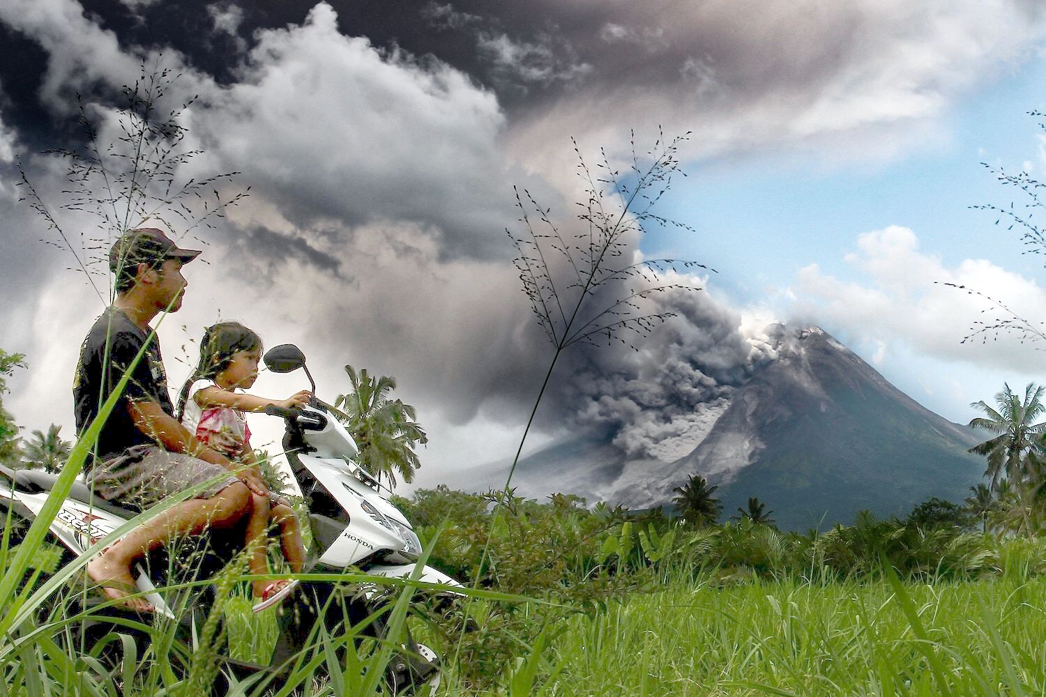
Mount Merapi volcano eruption in Indonesia

Mount Merapi, one of Indonesia’s most active volcanoes, erupted again yesterday, spewing volcanic ash up to 7 kilometres. Details of the eruption were reported by the country’s Geological Disaster Technology Research and Development Centre (BPPTKG).
The eruption occurred around 12.12pm local time and a lava flow of 1.5 kilometres was observed. For the past several months, the volcano situated on the border between Central Java province and the special region of Yogyakarta has been under level 3 alert due to frequent eruptions.
This level of alert indicates the possibility of a volcano eruption, which could have severe consequences for the surrounding regions.
Merapi, standing at 2,963 metres, is an extremely active volcano. The BPPTKG recorded that it had caused 553 volcanic earthquakes and discharged hot lava 19 times during the past week alone.
People have been advised by the authorities to stay away from the dangerous zone that covers a seven-kilometre radius around the peak of Merapi. Additionally, they have been warned to avoid the rivers, such as Krasak and Bebeng, that originate from the volcano after the eruption.
Yulianto, an official at the local monitoring post, said residents had not yet been ordered to evacuate, but the people in the nearby community have been warned to stop any activities in the danger zones, ranging between 3 to 7 kilometres radius from the epicentre.
“This has only been observed as a one-time event. There have been five to six avalanches. If the coverage continues to increase and the distance is further than 7 kilometres, the residents will likely be recommended to evacuate.”
Indonesia is located on the Pacific Ring of Fire, making it home to many active volcanoes. In 2010, the eruption of Mount Merapi killed more than 350 people and displaced many others. The volcano eruption also caused disruptions in flights and the closure of the Yogyakarta International Airport due to safety concerns.
Latest Thailand News
Follow The Thaiger on Google News:


