Tham Luang caves to be properly explored and mapped
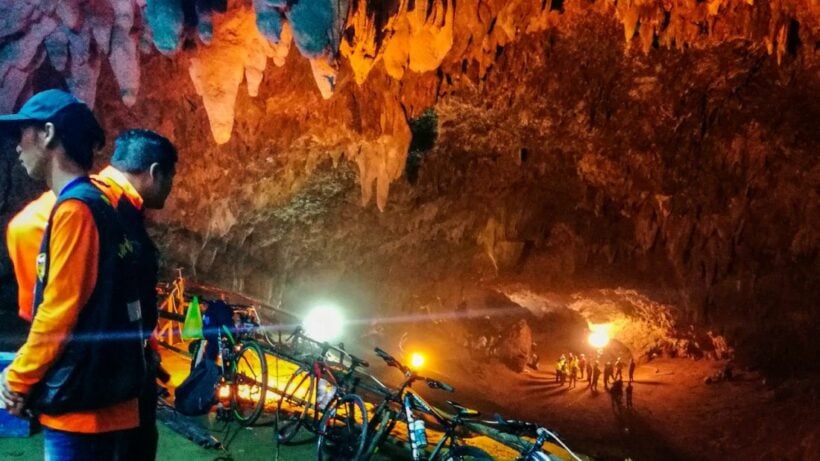
Local and foreign cave experts have been mapping the Tham Luang-Khunnam Nang Non cave, in the Mae Sai district in Chiang Rai, to create the first detailed map of the cave complex. The mapping follows confusion during the rescue, and mentioned last week by Vernon Unsworth, over the exact location where the boys were found.
Mr. Chaiporn Siripornpaibul says the project will take about two years and is intended to discover more information about the cave system, including detailed mapping of the complex, to be used for proper and efficient management of the cave for environmental, ecological and tourism purposes.
Thai PBS reports that, after Tham Luang, he said 20 more of Thailand’s over 5,000 caves would be explored for similar purposes.
Tham Luang-Khunnam Nang Non cave shot to worldwide fame in June last year when a massive international operation was mounted to rescue 12 young footballers and their coach trapped about 4 kilometres inside the flooded cave. The successful mission involved more than 10,000 people, including over 100 specialty divers from other countries and hundreds of professional rescue workers.
Mr. Chaiporn said that, although the cave exploration project would last two years, actual exploration would be restricted by flooding during the monsoon season, which normally starts in June and lasts until almost year’s end. He explained that Tham Luang cave sits on the path of a main water way which flows into the cave, rendering exploration impossible at times.
The cave system is about 10 kilometres long, but the team plans to explore up to the Nom Sao elevated grounds, or Pattaya Beach, about 2.2km from the cave entrance.
Meanwhile, Mr. Jongklai Worapongsathorn, deputy director-general of the Department of National Park, Wildlife and Plant Conservation, said that this exploration would provide some answers which could lead to more efficient cave management.


As well as British cave diving expert Vernon Unsworth and others, Mr. Jongklai said the exploration team has received support from National Geographic magazine which has loaned the team its three-dimensional laser scanner for use in cave mapping.
SOURCE: Thai PBS
Latest Thailand News


Follow The Thaiger on Google News: