Earthquake rocks Indonesia in Papua, on New Guinea

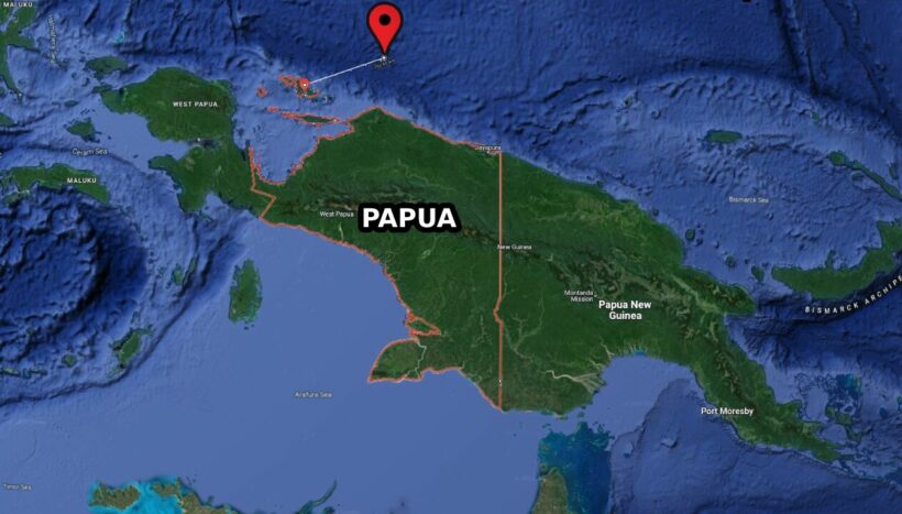
An earthquake measuring a magnitude of 6.2 on the Richter scale shook the island of New Guinea in the Papua province of Indonesia. It was the fourth in a row today as the Western New Guinea region has been tremoring throughout the morning.
Previous quakes measured magnitudes of 5.1 first just after midnight this morning, then 5.9 at 6.44am, followed by the largest earthquake of 6.2, which struck at 7.05am. While quakes in the magnitude of 5. x is moderate and more common, with over 1,000 per year, those above 6.0 are considered strong, can cause reasonable damage, and are much rarer with only 100 to 150 feet around the world each year.
Despite the powerful earthquake on the island, there have been no reports of casualties or significant damage in the area, and major waves have not been a worry, as no tsunami warnings have been issued.
The earthquake had an epicentre in the waters to the north of the main island, about 262 kilometres to the east-northeast of the little island of Biak off the northwestern coast of Papua. It struck at a depth of about 16 kilometres under the sea level, according to the Badan Meteorologi, Klimatologi, dan Geofisika (translating to Meteorology, Climatology, and Geophysical Agency), the agency that oversees such disasters and warnings.
Earthquakes, along with volcano eruptions are not uncommon throughout Indonesia, as it sits in a region known as the Pacific Ring of Fire. It is a convergence of tectonic plates deep beneath the Earth’s surface, and as the places press and rub against each other and the friction creates earthquakes and pushes magma triggering volcanic activity.
SOURCE: Thai PBS World
Latest Thailand News
Follow The Thaiger on Google News:


