Severe flooding in Mae Hong Son threatens rice fields
Heavy rainfall in Mae Hong Son has caused the Mae Sa Nga River to overflow, flooding over 1,000 rai of rice fields. The famous Sutongpe Bridge, a well-known tourist spot, is also at risk of submersion, with landslides blocking several roads.
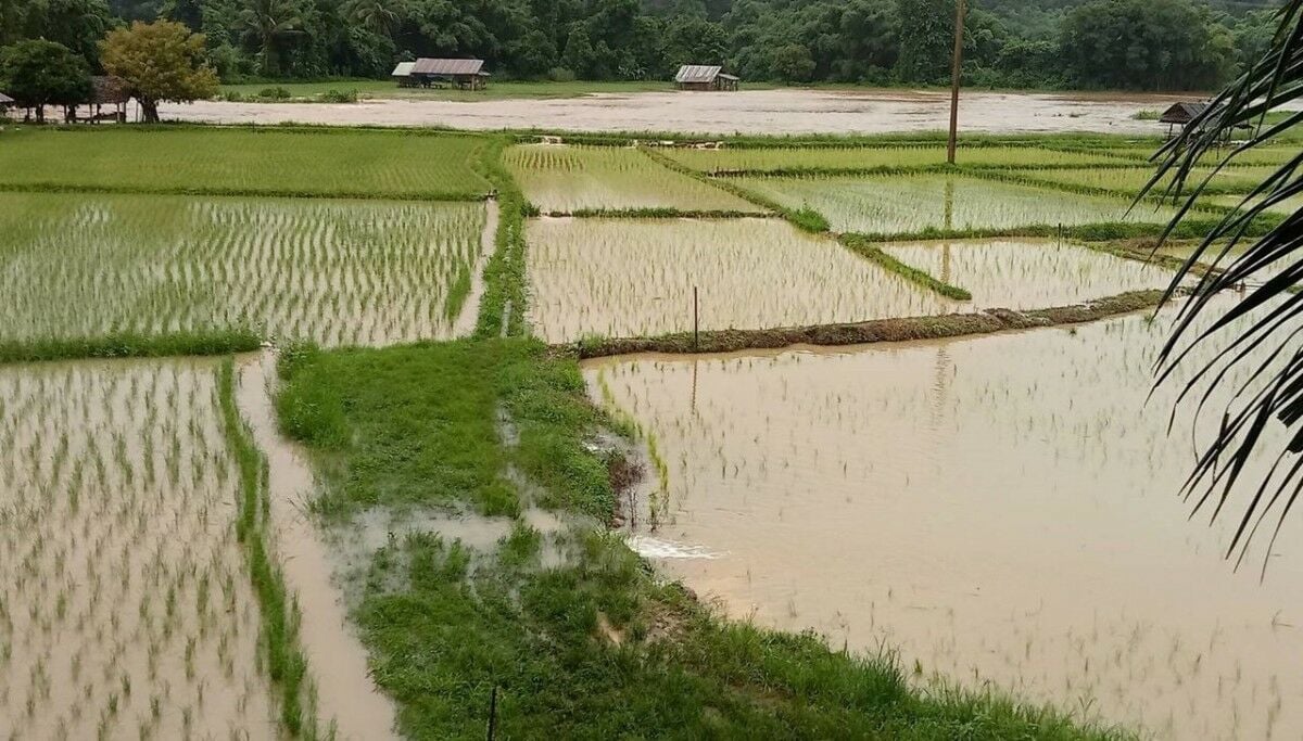
Mae Hong Son is currently facing a crisis due to continuous heavy rainfall which has led to severe flooding in the area. The Mae Sa Nga River has overflowed, resulting in significant damage to agricultural lands in the Mok Cham Pae and Pang Mu subdistricts of Mueang Mae Hong Son district. Over 1,000 rai of rice fields have been submerged, adversely affecting local farmers.
Sutongpe Bridge, a renowned tourist attraction, has also been impacted by the rising water levels. The flooding has spread extensively under the bridge, causing shopkeepers and food vendors in the area to hastily relocate their goods to higher grounds to avoid further losses.
The situation has been escalating since yesterday, as reported by Sangkham Kat Chiang Saen, the district chief of Mueang Mae Hong Son. Phryat Thamma Yodyiam, the village head of Kung Mai Sak in the Pang Mu subdistrict, confirmed that the Mae Sa Nga River’s overflow has led to widespread flooding of rice fields and other agricultural areas, resulting in significant damage.
Lieutenant Colonel Surachart Panyathep, head of the Naresuan Task Force’s 307th Reconnaissance Group, along with the Singhanat Task Force and the village committee, have been assessing the damage in Kung Mai Sak Village. The continuous heavy rainfall, which began around 9pm yesterday, July 31, caused flash floods, leading to the river breaching its banks and inundating farmland, including approximately 60 rai of crops. Despite the severe flooding, the Sutongpe Bridge remains structurally sound, having been reinforced last year.
Local officials and community leaders are closely monitoring the situation and coordinating with relevant agencies to provide necessary assistance. The flooding has not only affected agricultural areas but led to landslides, which have blocked several key roads.
Landslide blockage


The Doi Kiw Hok area, along the road between Na Pla Chad Village and Huai Sai Khao Village in Huai Pha subdistrict, has experienced a landslide, obstructing the route used for transporting goods to the Myanmar border. This blockage, which initially occurred yesterday and has since worsened, now affects two locations, disrupting trade and travel for local businesses and residents.
Additionally, the road between Hua Nam Mae Sakud Village and Huai Pu Ling Village in the Doi San Fa area has also been blocked by landslides of soil and rocks, further isolating residents.
The Pai River has seen a significant rise in its water level, currently measuring nearly 2 metres, due to the continuous rainfall in the upstream areas of Pai, Pang Mapha, and Mueang districts. This surge in water levels is expected to impact agricultural areas along the river, particularly those cultivating sesame plants in Pang Mu, Thung Kong Mu, and Sop Soi villages within the Pang Mu subdistrict, reported KhaoSod.
Latest Thailand News


Follow The Thaiger on Google News: