World News
World news, global politics, business, technology, and culture—stay updated with breaking stories, international trends, and major events. Get the latest from The Thaiger, your trusted source for global news.
-

Thai Airways welcomes first female pilot after 66 years
Thai Airways celebrated a milestone in its history after its first female pilot operated her inaugural commercial flight on the Bangkok-Hanoi route on Monday, June 1. The airline announced the achievement through its official THAI Corporate Communications Facebook page, highlighting Pannathon “Bam” Thanrungrueangchai’s first commercial flight as a pilot with the national carrier. According to Naewna, Pannathon is the first…
-
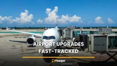
Thailand aviation hub push drives airport upgrades, flight routes
Thailand is ramping up airport upgrades and expanding domestic and international flight routes as part of a broader push to establish itself as an aviation hub and regional centre for travel, tourism, and investment. Deputy government spokesperson Lalida Persvivatana said the strategy aims to improve connectivity between major cities and emerging destinations while strengthening the country’s long-term aviation and logistics…
-
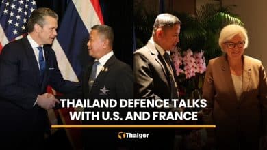
Thailand strengthens defence ties with US, France in Singapore
Thailand moved to strengthen defence ties with the United States and France during separate talks at the 23rd IISS Shangri-La Dialogue in Singapore on May 29. Thai Defence Minister Adul Boonthamcharoen met US Defence Secretary Pete Hegseth to discuss regional security and paths to strengthen defence ties between Thailand and the US. Adul said Thailand valued its long-standing alliance and…
-
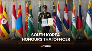
Thai army officer honoured in South Korea for truck rescue
A Thai army officer received a certificate of honour in South Korea yesterday, May 30, after helping rescue a driver from an overturned trailer truck on a road in Seoul earlier this month. Colonel Srisawat Sriprakon, a Thai army officer attending the National Defence College course in South Korea, received the certificate from Professor Lee Hong Sub, acting president of…
-
CAAT issues rules for tighter Ebola airport screening
Thailand is directing arrivals from DR Congo and Uganda through Suvarnabhumi Airport only under stricter Ebola surveillance measures, the Civil Aviation Authority of Thailand (CAAT) announced today, May 28. CAAT said that the Ministry of Public Health raised surveillance and disease prevention measures after Ebola outbreaks were reported in some areas of the Democratic Republic of the Congo and Uganda.…
-
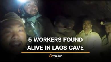
5 workers found alive after week inside flooded Laos cave
Rescue teams yesterday, May 27, located five Laotian workers trapped inside a flooded cave in Longchaeng district, Xaisomboun province, after more than a week. Two other workers remain missing. The seven workers became trapped after entering the cave on May 19 to search for gold before heavy rain flooded the area and blocked the exit routes. According to Thai PBS,…
-
Macron hosts Anutin as Thailand courts French investment
French President Emmanuel Macron hosted Thai Prime Minister Anutin Charnvirakul for a dinner meeting at the Élysée Palace in Paris yesterday, May 25, where both sides discussed trade, cybersecurity, and regional security issues. The meeting took place at 8.30pm local time in France. Both leaders agreed to strengthen trade and investment between the two countries, particularly in high-value industries including…
-
7 mine workers remain trapped in flooded Laos cave
Thai volunteer rescue teams joined a cave rescue mission in Laos after seven mine workers became trapped in a flooded cave since May 19 while searching for gold. Ten mine workers entered a cave in Longchaeng district of Xaisomboun province, but only three managed to escape. Seven others remain trapped inside the cave after heavy rain flooded the entrance and exit…
-
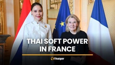
Thai soft power push marks 170 years of Thailand-France ties
Thailand is looking to France for lessons in turning culture into global influence, as Culture Minister Sabeeda Thaised led talks on May 22 to mark 170 years of Thailand-France diplomatic ties and push Thai soft power through five areas of cooperation. At 5.30pm local time, Sabeeda and senior Ministry of Culture executives met French Culture Minister Catherine Pégard during an…
-
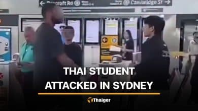
Thai student injured in attempted robbery at train station in Sydney
A Thai student suffered a head injury in an attack by a man who reportedly attempted to steal musical equipment at a train station in Sydney, Australia, on May 17. A Thai music teacher identified only as Luck shared details of the incident with a Facebook page operated by a Thai resident in Australia. The story was later reposted by…
-
AirAsia CEO warns airport fee hike could be ‘disaster’ for Thai tourism
AirAsia founder and CEO Tony Fernandes has opposed Airports of Thailand’s (AOT) proposed increase to the international passenger service charge (PSC), warning that higher airport fees could damage Thailand’s tourism industry during a difficult period for global aviation. Fernandes, chief executive officer of Capital A, said the timing was inappropriate as airlines worldwide continue to face pressure from rising fuel…
-
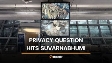
Questions raised over public viewing of Suvarnabhumi Airport checkpoint cameras
Concerns over passenger privacy emerged online after social media users questioned the public accessibility of CCTV footage at immigration checkpoints in Suvarnabhumi International Airport. The issue gained attention after a Thai X user criticised Airports of Thailand (AOT) when footage of a popular actor at the immigration checkpoint was circulated online. The user questioned whether sharing footage from security cameras violated…
-
Ebola risks in Thailand under watch after Congo outbreak
The Thai government has ordered the Ministry of Public Health to closely monitor Ebola risks in Thailand after the World Health Organisation (WHO) declared an Ebola outbreak in eastern Democratic Republic of the Congo an international public health emergency. Deputy government spokesperson Ploythalay Laksameesaengchan said Today, May 20, that the WHO declaration concerned an Ebola outbreak in Ituri province, eastern…
-
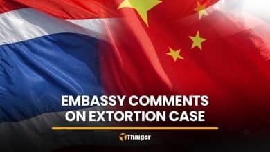
Chinese Embassy calls for transparency in Sa Kaeo extortion case
The Chinese Embassy in Thailand has responded to reporters over the alleged detention and extortion of Chinese nationals in Sa Kaeo, urging Thai police to investigate the case lawfully, fairly and transparently. The response follows the arrest of five police officers and one civilian in Sa Kaeo on May 16. They were accused of detaining five Chinese nationals and demanding…
-
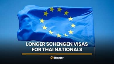
EU visa change opens path to longer Schengen visas for Thais
Thai nationals residing in Thailand may now qualify for Schengen visas valid for up to five years under new European Union (EU) rules announced yesterday, May 18, aimed at making repeat travel to Europe easier. The change is part of a new “visa cascade” system adopted by the EU, giving eligible repeat travellers progressively longer multiple-entry visas. It applies to…
-
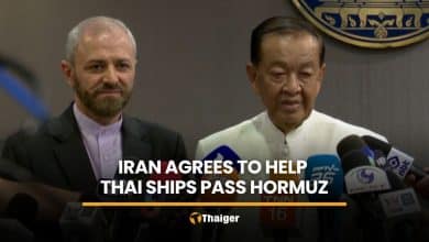
Iran agrees to help Thai cargo ships pass Strait of Hormuz
Two Thai cargo ships waiting to pass through the Strait of Hormuz are expected to receive assistance from Iran after a meeting at Government House yesterday, May 18. Wan Muhamad Noor Matha, chief adviser to the prime minister, met Mehdi Zare, cultural counsellor at the Embassy of Iran in Thailand, to discuss bilateral ties and the regional situation. After the…
-
Thailand, Bahrain mark closer ties ahead of 50th anniversary
Thailand and Bahrain agreed to strengthen cooperation in trade, investment, medical tourism, and food security following talks between Prime Minister Anutin Charnvirakul and Bahrain’s ambassador to Thailand today, May 14. Bahraini Ambassador Khalil Yaqoob AlKhayat met Anutin at the Government House during an official courtesy visit following his appointment. Anutin congratulated AlKhayat on his appointment and said Thailand values Bahrain…
-
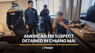
American FBI suspect detained in Chiang Mai over US warrant
An American suspect was detained in Chiang Mai yesterday, May 12, after Thai police received information from the Federal Bureau of Investigation (FBI) that he was wanted in the United States for assault and stalking. The American, identified as 58 year old Joseph Frances Chinnock, also known as Joseph Kelly, was wanted on a US arrest warrant. The FBI reportedly…
-
Royal Thai garments take centre stage at Paris exhibition
A Royal Thai dress exhibition has opened in Paris under the patronage of Princess Sirivannavari Nariratana Rajakanya, presenting royal garments, Thai textiles and contemporary designs at the Musée des Arts Décoratifs. The exhibition, La Mode en Majesté: Royal Thai Dress From Tradition to Modernity, opened today, May 13, and will run until November 1, 2026, in Paris, France. It is…
-
South Korean temporarily restricts Thai workers from 4 provinces in Isaan
South Korea temporarily restricted workers from four northeastern Thai provinces after some labourers reportedly absconded from their employers during seasonal employment programmes. Thailand’s Anti-Fake News Centre confirmed the measure yesterday, May 11, following widespread discussion on social media about an alleged ban on Thai workers entering South Korea. In a statement posted on its official Facebook page, the centre clarified…
-
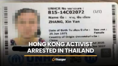
Hong Kong activist Zhang Xinyan arrested in Thailand
Hong Kong activist Zhang Xinyan, a wanted member of the overseas group Hong Kong Parliament, has been arrested in Thailand for overstaying her visa and is reportedly set to be deported to mainland China. According to the South China Morning Post, Hong Kong Parliament is an overseas pro-democracy activist group mainly founded and run by self-exiled Hong Kong activists. Sunai…
-
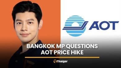
Bangkok MP questions AOT fee hike despite billion-baht profits
Bangkok MP Suphanat Minchaiynunt has questioned the government over AOT’s planned airport fee increase from 730 baht to 1,120 baht per international departure passenger from June 20, 2026. The increase of more than 50% has drawn public debate amid rising living costs and higher travel expenses. AOT cited the need to fund airport improvements to meet ICAO standards. Suphanat Minchaiynunt…
-
Lisa joins World Cup 2026 opening line-up
Thai singer Lalisa Manobal, known globally as Lisa BLACKPINK, has been officially announced by FIFA as one of the headline performers for the opening ceremony of the 2026 FIFA World Cup in the United States. FIFA confirmed the line-up yesterday, May 9, saying the opening event in Los Angeles would launch what it described as a historic summer of football…
-
Philippines hosts talks as Thailand, Cambodia seek renewed trust
Thailand and Cambodia agreed to rebuild trust and open a new chapter in bilateral relations after three-way talks initiated by the Philippines during the 48th ASEAN Summit in Cebu yesterday, May 7. Prime Minister Anutin Charnvirakul met Cambodian Prime Minister Hun Manet and Philippine President Ferdinand Marcos Jr at the Shangri-La Mactan hotel in Cebu to discuss the Thailand-Cambodia situation,…
-
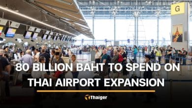
Thailand plans 80 billion baht airport expansion to become aviation hub
Thailand airport expansion projects worth around 80 billion baht are being prepared as the government moves ahead with plans to position the country as a regional aviation hub. Deputy Prime Minister and Transport Minister Phiphat Ratchakitprakarn recently met with Airports of Thailand (AOT) executives and related officials to discuss aviation development projects aimed at improving airport facilities and passenger capacity.…
-
Major Indian airlines warn fuel crisis could stop operations
India’s aviation sector could face major flight disruption after three major Indian airlines warned the government that rising fuel costs may force carriers to stop operating without urgent support. According to foreign media reports, Air India, IndiGo, and SpiceJet submitted a letter to the Indian government calling for changes to the Aviation Turbine Fuel (ATF) pricing mechanism, as well as…
-
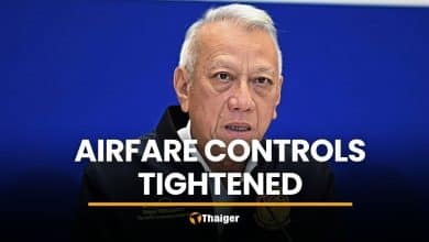
Transport Ministry tightens airfare controls as airlines eye price hikes
Thailand’s Ministry of Transport yesterday, April 28, ordered airlines to keep planned airfare increases under the legal airfare price cap after rising fuel costs pushed up operating expenses across the aviation sector. Deputy Prime Minister and Transport Minister Phiphat Ratchakitprakarn said the issue does not affect only Thai Airways, but all airlines, as fuel prices continue to rise. “The impact…
-
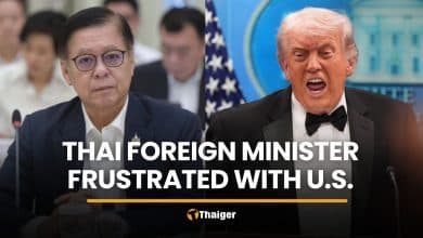
Thai FM expresses frustration with US over war fallout
Thailand’s foreign minister has voiced frustration with the US, saying Washington offered no direct help to its long-standing treaty ally as rising fuel, fertiliser, and shipping costs from the US-Israel war against Iran continue to plague Thailand. Deputy Prime Minister and Foreign Affairs Minister Sihasak Phuangketkeow told The Washington Post that the Trump administration appeared aware of the damage but…
-
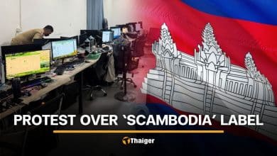
Cambodia pushes back against ‘Scambodia’ label in US media
Cambodia protested against the use of the term “Scambodia” in a Wall Street Journal (WSJ) article published on April 19, demanding its removal, which WSJ refused. The article, titled “How Cybercrime became a leading industry in ‘Scambodia’,” stated that Cambodia is a major global hub for scam operations, with compounds described as being the size of small towns. It also claimed…
-
CP Group signs MoU with SEGA to explore ASEAN IP growth
CP Group has signed a memorandum of understanding (MoU) with Japan-based SEGA Corporation to explore entertainment business opportunities in Thailand and the ASEAN region, the companies announced yesterday, April 27. The agreement focuses on combining SEGA’s global intellectual property (IP) and content development expertise with CP Group’s business ecosystem and regional network. Under the MoU, both parties will begin by studying…


Broke? Find employment in Southeast Asia with JobCute Thailand and SmartJob Indonesia. Rich? Invest in real estate across Asia with FazWaz Property Group or get out on a yacht anywhere with Boatcrowd. Even book medical procedures worldwide with MyMediTravel, all powered by DB Ventures.