The ins and outs of remote sensing applications in Thailand
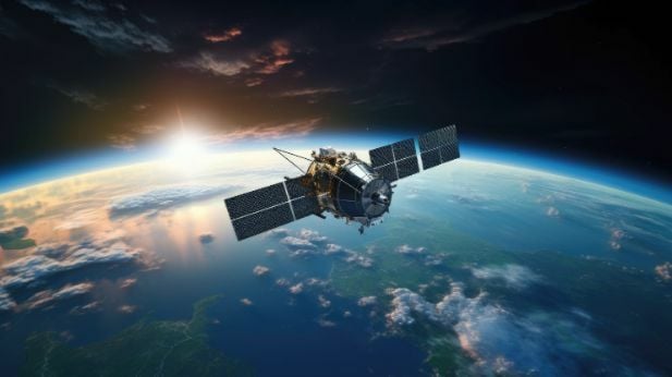
The advent of remote sensing technology, which allows observing and measuring Earth’s features from a distance, reshaped how we learn about the environment and deepened our understanding of the planet’s inner workings. Thailand was the first among Southeast Asian countries to recognize the critical role of remote sensing and actively integrate it into natural resources inventorying and environmental monitoring.
1971 marked the onset of the remote sensing era with the launch of the Thailand Remote Sensing Programme (TRSP), which unlocked access to the Landsat mission’s data. In the following decades, the country set up the Thailand Ground Receiving Station to acquire and process multi-level satellite data from Earth observation (EO) satellites and distribute it within the Asian region and worldwide. The establishment of the Thai National Space Agency and research organization GISTDA in 2000 and the launch of their own Earth-observing THEOS satellites were the game-changing milestones that fueled the ubiquitous use of spaceborne insights across a whole range of industries, including agriculture, forestry, geology, oceanography, disaster management, and urban planning.
The Inside Look at Remote Sensing
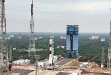
By sending THEOS-1 and -2 satellites to orbit our “blue marble” alongside over 1,100 other operational EO spacecraft, Thailand obtained its own source of precise, up-to-date remotely sensed data. This helped overcome the limitations associated with open-access satellite data – such as coarser spatial resolution of images and less frequent revisit times – while reducing the need to buy high resolution satellite imagery from commercial providers. Although some of this imagery is made freely available by government agencies and research organizations, having a proprietary fleet of high-resolution satellites empowers countries to tap into the remote sensing potential in emergencies, such as disaster response and environmental monitoring.
But how does remote sensing actually work? This process involves using various sensors carried by satellites and drones to collect information about objects from afar, particularly by measuring how they reflect and emit radiant energy, such as sunlight. Similar to how people have unique fingerprints, every object on Earth – be they a tree, a mountain rock, or a water body – has a unique way of interacting with electromagnetic radiation known as a “spectral signature” that depends on the object’s material and energy wavelength. Based on this, we can tell different objects apart and, more importantly, unravel differences in their state, for example, detect unhealthy plants or polluted rivers from space.
Satellite remote sensing encompasses an array of optical, radar, and LiDAR sensors to capture a diverse range of geospatial information via various techniques, such as passive and active sensing. Passive sensors measure radiation emitted by other sources, while active sensors emit one of their own. Moreover, satellite sensors differ in their spatial, temporal, and spectral capabilities, which determine the level of detail, frequency of image updates, and the scope of analyses.
For instance, the expression “high-quality satellite images” usually refers to spatial resolution, which is measured in meters per pixel and gives the idea of how detailed an image can be. On a spatial scale, there is low, medium, high, and very high-resolution satellite imagery – an extensive range that varies from hundreds of meters per pixel to tens of centimetres per pixel. Regarding use cases, the lower spatial resolution suits large-scale projects, such as land cover mapping. In comparison, higher-resolution satellite images prove indispensable in object detection and disaster damage assessment.
Crop Monitoring and Management
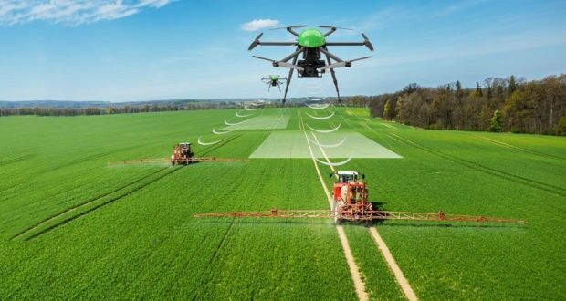
Within the range of remote sensing applications, Thailand’s agriculture has benefited the most. Agricultural production has driven the country’s development and, to this day, remains the livelihood basis for the majority of the Thai population. Satellite-powered remote sensing became a cost-effective tool for enhancing the core subsector – crop production. The main focus is on the major economic crops, such as rice, rubber, oil palm, pineapple, sugarcane, and cassava. Precise monitoring of crops from space supplies critical information about plant health, development, soil conditions, and water use throughout the growing season, enabling farmers to optimize their crop management strategies. Ultimately, informed decision-making boosts yields and minimizes environmental outcomes.

Satellite data has been successfully utilized for countrywide differentiation of crop types, crop acreage assessment, and yield forecasting. Estimating crop damage caused by drought, floods, and locust infestations and monitoring changes in cultivated land use represent another set of remote sensing applications.
Urban and Regional Planning
Remote sensing data from satellites became a budget-saving alternative for mapping land use; for example, satellite-based mapping costs the Land Development Department of Thailand six times less than aerial surveys. Satellites enable accurate land use classification to map urban, industrialized, and rural areas, water resources, and other critical objects to improve national resource planning.
This entails, by far, the most crucial use of satellites in the rapidly urbanized world – monitoring urban development and sustainable city planning. Remote sensing provides input data for building detailed, up-to-date maps for city planners. Spaceborne data makes keeping tabs on urban sprawl, detecting changes in land use, and overseeing environmental compliance of construction projects more efficient and precise.
One of the current urban challenges in Thailand is the shrinking of provincial cities and their declining population. However, local governments haven’t done much to reflect the declining trend in city management policies. By using satellites for regular analysis of the built-up area expansion, they can more accurately determine the city’s urbanization stage and take appropriate management action, keeping apace with the urbanization processes for long-term city sustainability.
Water Resources Management
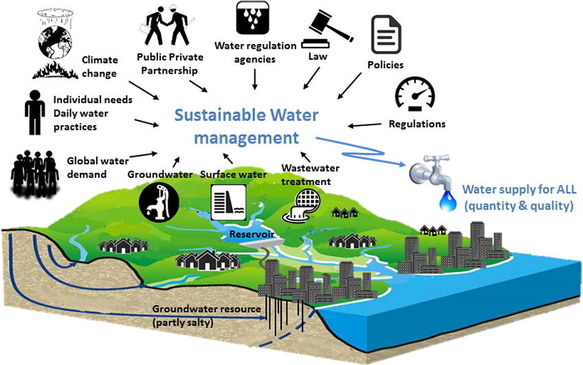
Sustainable water management is critical for Thailand in terms of industrial and human consumption. Remote sensing using satellites plays a vital role in estimating and efficiently managing water resources. Satellites are used to monitor water bodies to track water retention capacity throughout rainy seasons and mitigate drought impact during dry seasons. Deriving insights into water quantity at different times enables improved irrigation and water distribution across sectors. Additionally, satellite sensors can be utilized to assess water quality.
Hydrologic and weather data from satellites can assist in flood-related applications, including forecasting floods and mapping flood-prone areas, monitoring flooded zones, and assessing the damage caused.
Environmental Conservation
Satellite remote sensing technology stands guard over rich biodiversity and diverse ecosystems hosted by Thailand’s continental and maritime regions. Using it, environmental organizations can keep track of the detrimental changes to forests, coastal areas, coral reefs, and water bodies caused by human activities and climate change. Equipped with up-to-date information on the hotspots and scale of damage, policymakers can better target conservation efforts to curb deforestation, industrial and agricultural expansion, coastal erosion, water pollution and turbidity.
The gradual integration of remote sensing data, originating in the 1980s, has transformed Thailand’s major industries, assisting in enhancing agricultural production levels, efficient management of natural resources, and environmental protection. This developing country can ensure stronger climate resilience and sustainability in its growth path by strategically utilizing ever-advancing satellite technologies.
Latest Thailand News


Follow The Thaiger on Google News: